NOAA’s Coral Reef Conservation Program (CRCP) uses benthic mapping data on coral reef ecosystems to support a variety of science-based management decisions. To efficiently allocate limited mapping resources, CRCP recognized a need to identify data gaps in high-priority locations based on emerging management requirements in U.S. coral reef management jurisdictions. Results from this project will enable CRCP, stakeholders, and participating groups to identify locations of mutual interest, leverage expertise and resources, and identify potential partnerships for future mapping efforts.
Why We Care
The health of U.S. coral reef ecosystems relies on the effective use of mapping data, science, tools, and strategies to inform management decisions. Coordination among local managers and researchers avoids duplicating efforts, raises awareness of available mapping data, and targets new collections for the highest-priority locations for future data collection efforts. Information from local stakeholders and agencies on where and what kind of data are needed for effective coral reef management will help guide and prioritize future benthic mapping efforts.
CRCP partnered with NCCOS to conduct a comprehensive, shallow-water gap analysis within all seven U.S. shallow coral reef areas. NCCOS led a mapping prioritization effort and data inventory to identify 1) the availability of existing data and products and 2) priority locations and approaches for future data products.
What We Did
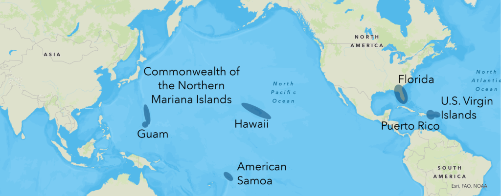
From 2021–24, NCCOS built a digital inventory of relevant shallow water (up to 40 m) mapping datasets and conducted a data needs assessment for each of the CRCP jurisdictions: Florida, Puerto Rico, U.S. Virgin Islands, Hawaii, Guam, American Samoa, and the Commonwealth of Northern Mariana Islands (CNMI) (Figure 1).
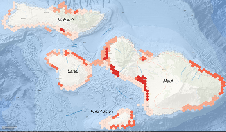
To identify prioritized areas of data needs within each jurisdiction, researchers used a spatial framework and participatory online tool to solicit input from select local participants (Figure 2). Using methods similar to prioritization efforts elsewhere in the U.S. (i.e., West CONUS Coast, U.S. Caribbean, and Southeast U.S.), the team combined participants’ input to identify areas of high priority for collecting contemporary, high-quality mapping data. Ultimately, this will provide CRCP and local managers with a detailed framework for future mapping management needs to protect, conserve, and restore the nation’s coral reefs. The focus of this effort supported the four thematic areas of CRCP’s strategic plan.
Results can be viewed and downloaded on the project’s online hub and from the links in the data products section below.
Benefits of Our Work
CRCP has expressly identified the need to create a mapping data inventory and provide a needs-based framework for future mapping efforts within shallow coral reef areas. Results from this project fulfill CRCP’s need and will benefit local jurisdictional communities, resource agencies, and other participating organizations by: (1) identifying regions of overlapping data needs, (2) promoting coordination among participating organizations, and (3) enabling partners to leverage resources to fill their most pressing data needs and information gaps.