We developed a geospatial framework and online application to identify priorities for seafloor mapping along the U.S. Southeast Atlantic Coast (NC, SC, and GA). This project enables federal resource agencies and participating organizations to more effectively coordinate assets, and efficiently guide future seafloor mapping, research, and exploration activities.
Why We Care
Spatial information about the geomorphology, surficial habitats, and underlying geology of the seafloor is critical for decision-making by marine research and management organizations tasked with ensuring safe navigation, sustainable fisheries, smart energy extraction, and sound ecological stewardship and conservation in U.S. coastal and ocean waters. Mapping the seafloor in the entire US Exclusive Economic Zone is a top national priority and NOAA is helping achieve this goal. Improving coordination of seafloor mapping goals among research and management organizations will result in better resource leveraging to survey seafloor areas while achieving each agency’s mandates and missions faster and cheaper.
To help promote coordination in the region, NOAA’s Southeast and Caribbean Regional Collaboration Team and National Centers for Coastal Ocean Science developed a participatory mapping and web-based tool to identify common spatial management priorities across partner organizations. This framework spatially captures and summarizes:
- What locations are important?
- Why are they important?
- How quickly is data collection needed?
- What data products are needed most?
Our approach has been successfully applied in the state of Washington, Florida, New York and Alaska, as well as regions of the Great Lakes, US Caribbean and West Coast. We plan to use this established and tested, participatory mapping process to help NOAA, other Federal and partnering organizations in the Southeast US Atlantic Coast identify seafloor mapping and prioritized seabed survey needs.
What We Did
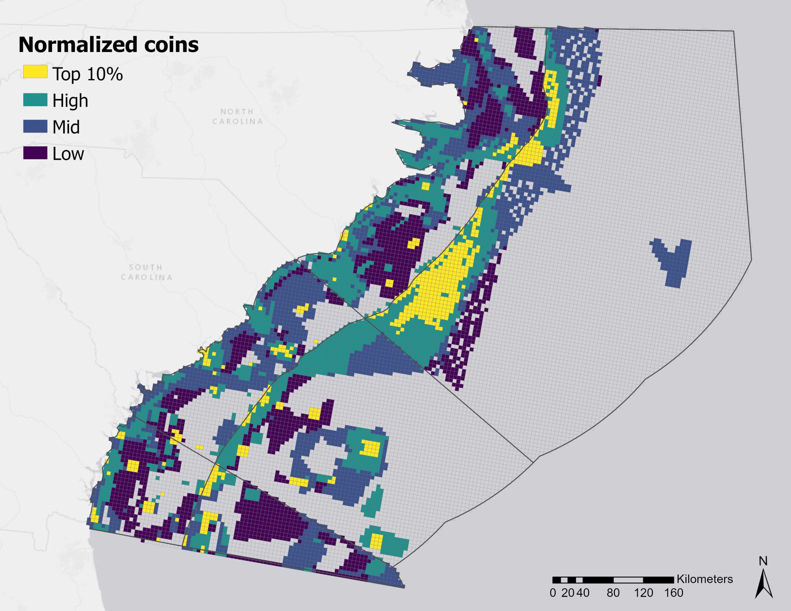
The prioritization application contained existing geospatial data available through GIS portals (e.g., essential fish habitats, habitat areas of particular concern, energy lease areas, navigation, etc.) and data provided by partners. The inventory of spatially relevant datasets provided the context for participants to designate their organization’s priority areas. Results from 25 participating organizations were analyzed using clustering and other spatial statistical techniques to identify significant relationships among priorities, issues, and ranking criteria.
“Predictive models show areas of deep corals, but new bathymetry and seafloor maps are critical to validate these models” – SE Prioritization Participant
Final results are publicly available on an interactive map and integrated into other relevant products, including justification for NOAA fleet allocation, ocean exploration mission planning, Integrated Ocean and Coastal Mapping and Inter-agency Working Groups, and toward SEABED 2030. They were also compiled into a technical report and shared with operating and funding agencies to assist with aligning programmatic goals and resource allocation. Read the report: https://doi.org/10.25923/qh2c-hs73
Benefits of Our Work
The compiled seafloor mapping priorities will (1) help organizations better understand how their priorities align with other SE US partner needs, (2) better position participating organizations to more efficiently coordinate projects, and (3) better enable partners to leverage assets and resources to fill their most pressing data and information gaps in the Southeast US coastal and outer continental shelf.