We developed a spatial framework and online application to identify priorities for seafloor mapping and visual surveys along the U.S. west CONUS coast (WCC), off California, Oregon and Washington. This project will enable federal resource agencies and participating organizations to more effectively coordinate assets, and efficiently guide future WCC seafloor mapping, research, and exploration activities.
Why We Care
Spatial information about the seafloor is critical for decision-making by marine research and management organizations. These organizations are tasked with ensuring safe navigation, sustainable fisheries, smart renewable energy, oil and gas extraction, and sound ecological stewardship and conservation in U.S. coastal and marine waters. For example, recently gathered information helped inform decisions in 2018 by the Pacific Fishery Management Council to close 136,000 square miles and re-open 3,000 square miles of seafloor to bottom trawling, in an effort to improve management of essential fish habitat. However, collecting spatial information about the seafloor is expensive and time consuming, making its collection challenging for individual organizations. Coordination among these research and management organizations can help them more efficiently leverage resources to map and explore unknown seafloor areas in support of their individual objectives, mandates, and missions. Effective coordination requires that these organizations understand where and when their priorities overlap with others operating in the same regions.
To help promote coordination and fill these information gaps, NOAA NCCOS developed a spatial framework and tool to identify common research priorities across partner organizations. This framework spatially captures and summarizes answers to questions such as:
- What locations are important?
- Why they are important?
- How quickly is data collection needed?
- What data products are needed most?
This approach has been successfully applied by NCCOS in various regions around the U.S., including in the U.S. Caribbean, Lake Michigan, South Atlantic, offshore of southern California, New York, and Washington state. Here, NCCOS will use this well-established spatial process to help participating organizations on the WCC to identify seafloor mapping and visual survey priorities from California to Washington. This prioritization process is designed to be iterative, and could be repeated and expanded to include other partner organizations as needed in the future.
What We Are Doing
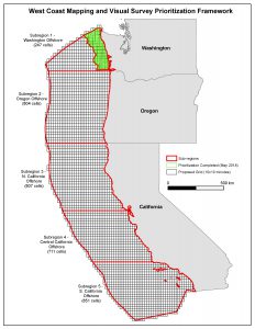
This project’s objective is to identify and summarize spatial priorities for seafloor mapping and visual surveys from California to Washington. Seafloor mapping is defined as using sound navigation and ranging (SoNAR) to make maps of the surficial seabed and/or sub-bottom features. Visual surveys include underwater video collection using towed camera sleds, remotely operated vehicles (ROVs), and autonomous underwater vehicles (AUVs). This prioritization does not include in situ sampling, cores, bottom grabs, etc. NCCOS will build on recent west coast prioritization efforts conducted offshore of Washington, and expand geographically to include California and Oregon. This effort will use GIS data from ongoing NCCOS projects along the WCC, including BOEM’s Pacific Cross-shelf Macrofauna and Deep-Sea Coral Suitability Modeling and Pacific Marine Bird Modeling projects. Other relevant, readily-available GIS data sets (e.g., essential fish habitats, habitat areas of particular concern, energy lease areas, etc.) will be provided in the prioritization application from existing data warehouses (e.g., NOAA NWFSC FRAM) or if provided by partners in readily-accessible GIS formats. These data sets can be viewed by participating organizations to help guide their selection of high priority areas.
We will apply an analytical approach similar to the one used in the most recent Washington State prioritization effort. Participant priorities will be entered into an online portal using an existing process and widget developed by NCCOS. Results will be analyzed using clustering or other relevant techniques to identify significant relationships between priorities, issues, and ranking criteria. Spatial patterns will be mapped using frequency and hotspot analysis. Preliminary results from the prioritization process will be reviewed and finalized by partners online. Final prioritization results and maps will be compiled in a technical report. This report will help guide future mapping and visual survey activities on the WCC, including those conducted by the Expanding Pacific Research and Exploration of Submerged Systems (EXPRESS) campaign and NOAA’s Deep Sea Coral Research and Technology Program’s West Coast Deep-Sea Coral Initiative (WCDSCI).
Benefits of Our Work
This work is funded by NOAA’s Deep Sea Coral Research and Technology Program (DSCRTP) through its FY19–21 West Coast Deep-Sea Coral Initiative (WCDSCI). The work described here will benefit WCC federal resource agencies and other participating organizations by: (1) helping organizations better understand how their priorities align with other WCC partner needs, (2) better positioning participating organizations to more efficiently coordinate across projects, and (3) better enabling partners to leverage assets and resources to fill their most pressing data and information gaps from California to Washington. This work was designed to support a wide range of organizations actively participating in the EXPRESS campaign and NOAA’s DSCRTP WCDSCI. However, this prioritization process is designed to be iterative, and could be repeated and expanded to include other partner organizations as needed in the future.