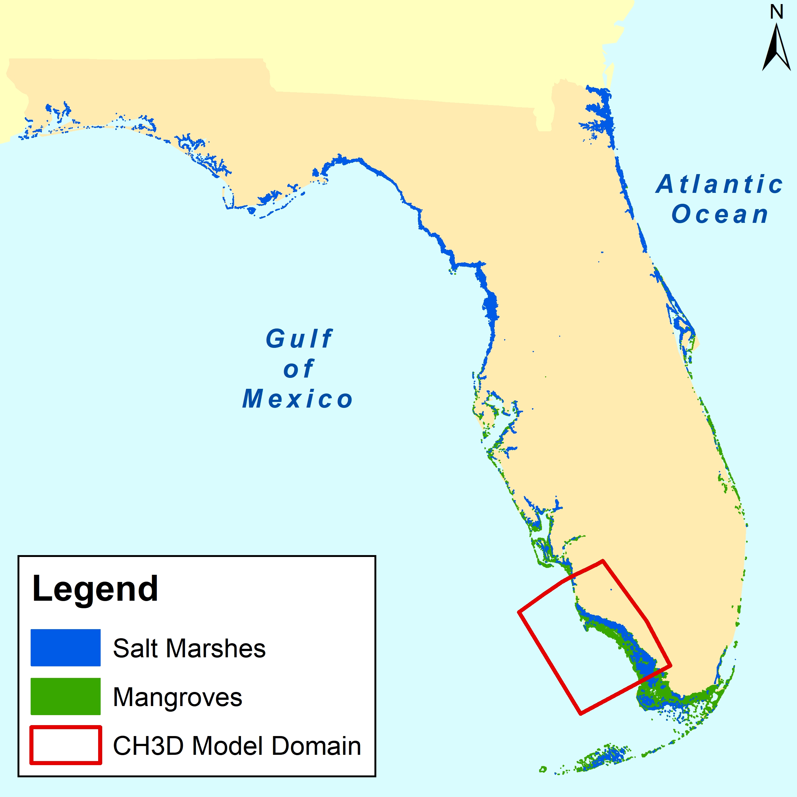
We will simulate sea level rise and rainfall scenarios to determine how mangroves in southwest Florida will be affected in the future and what protection they will provide against flooding, providing insights for future restoration opportunities.

Why We Care
Coastal urban and natural ecosystems are seeing more flooding due to sea level rise and an increase in rainfall. Southwest Florida is experiencing greater vulnerability to flooding due to a growing coastal population, frequent and more intense hurricanes, sea level rise, and salt-water intrusion into aquifers. Natural features like mangroves and marshes can help mitigate these flood risks, but the fate of these natural features as a consequence of climate-induced environmental change remains uncertain.
What We Are Doing
We aim to determine how natural features may have to be managed and restored in the future to provide flood protection for residents of southwest Florida. Our work will advance high-resolution flood hazard maps to include information on the potential role of natural features to reduce flood risks.
The project will enhance a mangrove vegetation model to predict the future distribution of mangroves and marshes, incorporate rainfall-induced inland flooding into coastal flooding models, and simulate the role of natural features in reducing flooding during past and future storms and king tide events. The project team, using input from coastal managers and planners, will assess the economic impacts and merits of restoring natural features. The team will also describe the impact of coastal and inland flooding on the urban storm water system.
Benefits of Our Work
Our study will improve the understanding of how marsh and mangrove habitats in southwest Florida are currently providing flood reduction through surge protection and water holding services and how that will change under different habitat restoration scenarios and sea level rise. The project team will provide a landscape‐scale, process‐based mangrove vegetation model that predicts future distribution and structure of habitats, incorporating the effects of changing sea level, storms, and salinity. This will allow for the evaluation of how natural and nature-based feature restoration scenarios impact future flood risk and economic impact.
The project is led by the University of Florida and is funded through the NCCOS Ecological Effects of Sea Level Rise Program. Project partners include Florida Gulf Coast University, the South Florida Water Management District, the Rookery Bay National Estuarine Research Reserve, and the U.S. Geological Survey. This project builds on the ongoing NOAA RESTORE Science Program project in the same region through its emphasis on mangroves.
