We are identifying the coastal wetlands in Georgia, South Carolina, and Delaware Bay that are most vulnerable to sea-level rise and quantifying the value of benefits they provide. We are also forecasting the change in areal extent of wetlands in the study area and the associated cost of lost services. A collaborative stakeholder approach will evaluate and refine the products produced to inform end users where proactive interventions are most needed.
Why We Care
Tidal marshes are recognized as important natural and nature-based features (NNBF) in coastal regions, especially in their capacity to serve as buffers between storms and upland development and infrastructure. As sea level rises, tidal marshes are expected to experience increased tidal inundation and saltwater intrusion — effects that are likely to result in losses to total marsh area and in changes to ecological functioning and protective features of those marshes that remain. The decline in protective marsh ecosystems puts coastal communities at increased risk for flooding that could lead to infrastructure damage and loss of land and life during storm events. Identification of marshes that are most susceptible to drowning that currently provide critical services is a priority, thus allowing for optimization of efforts and benefits gained from investments in future management, restoration, and adaptation.
What We Are Doing
The project has five objectives designed to lead coastal communities toward greater coastal resilience in three coastal regions of the U.S. East Coast:
-
- Project marsh resilience and loss;
- Determine and monetize protective and non-protective services at risk;
- Identify vulnerable marshes for management review;
- Ensure utility of research findings by following end-user driven process during research stages and online tool development; and
- Expand application to future resource managers by creating educational modules.
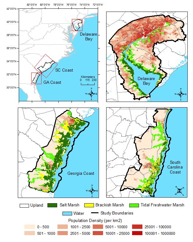
Combining field research, modeling and economic analyses, the project team will identify and value protective and non-protective NNBF services provided by tidal marshes and share them in a familiar, interactive Google Earth format shaped by end-user engagement. As both the economic priorities and the response of coastal wetlands will vary along the eastern U.S. seaboard, the tidal regions of the three systems will be assessed. These are Delaware Bay (NJ/PA/DE), North Inlet through the Ashepoo Combahee and South Edisto (ACE) Basin (SC), and the Altamaha River Estuary and surrounding watersheds (GA). Each contains one or more NOAA National Estuarine Research Reserves (NERRs).
This project couples two existing models, MEM (Marsh Equilibrium Model) and SLAMM (Sea Level Affecting Marshes Model) and integrates remotely sensed techniques to provide accurate, spatially explicit predictions of changes in marsh type and extent in each of the three coastal systems in response to sea-level rise scenarios. The services to be monetized will be identified in consultation with the project’s Management Transition Advisory Group (MTAG).
Benefits of Our Work
By translating the change in coastal wetland into monetary terms that account for the residents’ willingness to pay for these services, the economic valuation will allow coastal communities to prioritize and rank investments. In addition to direct results of sea-level rise, several end-user driven scenarios will be incorporated, facilitated by the MTAG, that include the interaction with human land-use decisions that indirectly affect wetland extent. Coastal managers and other end users will be able to examine the spatial variation of benefits across neighborhoods within a given scenario, as well as differences between the scenarios, allowing coastal communities to analyze where NNBF investments can maximize benefits while accounting for existing and future private and public adaptation measures.
The project is led by Dr. Lori Sutter of the University of Georgia with co-investigators Dr. Yukiko Hashida and Dr. Deepak Mishra also of the University of Georgia and Dr. Nathaniel Weston at Villanova University. This project is part of the NCCOS Effects of Sea Level Rise Program Program.