Marine debris injures and kills marine life, interferes with navigation safety, and poses a threat to human health. We are investigating and codifying a process to detect and identify marine debris on the shoreline using Uncrewed Aircraft Systems (UAS)–based imagery, machine learning, and advanced sensors. We will define a set of feasible operational procedures and workflows for NOAA’s Marine Debris Program and partners to develop marine debris heat maps for locating and identifying marine debris using UAS.
Why We Care
Our oceans and waterways are polluted with a variety of marine debris, ranging from soda cans and plastic bags to derelict fishing gear and abandoned vessels. This debris, also known as marine litter, is a global problem that threatens our environment, navigation safety, coastal economies, and potentially human health.
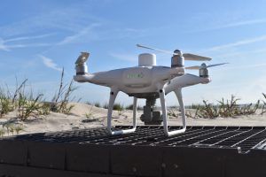
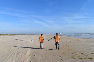
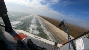
The ability to detect and identify marine debris quickly and accurately is key to cleanup and response actions that can prevent these adverse impacts. Uncrewed Aircraft Systems (UAS) offer this capability. They can be used to rapidly respond to severe debris events, such as hurricanes and tsunamis; to acquire high-resolution imagery over targeted coastline; and to access areas that are inaccessible by foot or small boat.
Though previous research has documented the benefits of UAS for marine debris mapping, there are still no operationally viable procedures and workflows suitable for consistent implementation by NOAA’s Marine Debris Program and their partners.
What We Are Doing
Our goal is to design and demonstrate a relatively low-cost, easily deployed, and accurate marine debris detection system that could be used by existing marine debris response programs.
The researchers will leverage previous procedures, workflows, and UAS Guidelines completed by the project team (Slocum et al. 2019), and integrate new technological innovations tailored to address the NOAA Marine Debris Program’s challenges and use cases. Innovative approaches to be investigated include use of UAS-based polarimetric imaging, which can be beneficial for detection of anthropogenic objects within a scene, and use of machine learning algorithms for automated detection and type classification of debris. The team will develop and test workflows that produce georeferenced heatmaps representing concentrations of marine debris (number of debris items per unit area), which can guide cleanup and restoration. Additionally, the team will use machine learning techniques to develop auto-detection and classification capabilities that allow users to easily input their imagery for debris detection. The procedures will be described in a standard operating procedures document, and training will be provided to NOAA Marine Debris Program staff to build capacity for assessment and execution of future UAS operations.
The project directly addresses the NOAA Marine Debris Program’s FY16–20 Strategic Plan Research Goal to “Identify, assess and reduce the impacts of marine debris through detection, monitoring, source identification and innovative solutions.” The project can also address:
- Testing/comparison of new and emerging UAS sensors and platforms,
- Prioritizing areas for debris removal,
- Determining whether substantial accumulations exist that merit removal activities,
- Overlay marine debris concentration maps with priority habitat areas,
- Developing and testing operational procedures,
- Enhancing post-processing efficiencies,
- Auto-detection and material-type identification via machine learning, and
- Combining data on debris concentration and material type to inform removal strategies and priorities.
The project is a collaboration among four groups and several researchers: Tim Battista with NOAA’s National Centers for Coastal Ocean Science (NCCOS) in Silver Spring, MD; Amy V. Uhrin from NOAA’s Marine Debris Program in Silver Spring, MD; Chris Parrish, Richie Slocum and Kyle Herrera with the College of Engineering, Oregon State University, Corvallis, OR; and Peter Murphy with Genwest Systems, Inc., in Edmonds, WA, and contracted to NOAA’s Marine Debris Program.
What We Are Finding
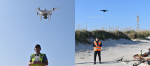
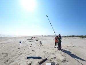
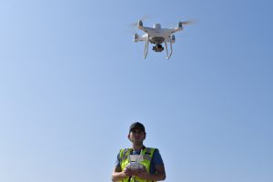
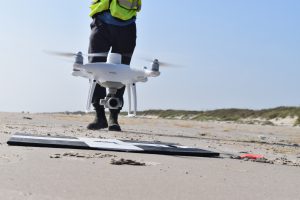
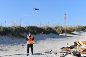
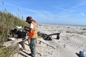
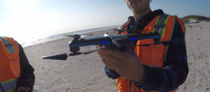
To date, the team has: 1) tested Polarimetric images in controlled settings with a variety of marine debris types and developed methods to easily analyze the data captured by these images; and 2) conducted overflights of coastal test sites in Oregon. At these test sites, researchers have placed a variety of representative marine debris over varying shoreline types to explore optimum UAS flying parameters and improve algorithms to detect the debris. Also, the team has been expanding and annotating the marine debris validation data that will be used to train the machine learning auto-detection algorithms.
Benefits of Our Work
- Identify suitable UAS system/payload for use by NOAA Marine Debris Program staff and partners and marine debris operations, generally.
- Determine optimal data acquisition parameters.
- Automate detection and material type classification.
- Develop and implement operationally efficient workflows and deployable algorithms.
- Develop a technical memoranda and standard operating procedures.
- Train NOAA Marine Debris Program staff and partners on how to use the system.
Next Steps
By summer 2022, the team will publish Standard Operating Procedures. This report will provide results and findings from project studies, as well as tools and guidance to NOAA Marine Debris Program and external partners for operational use of UAS to facilitate marine debris detection and mapping.