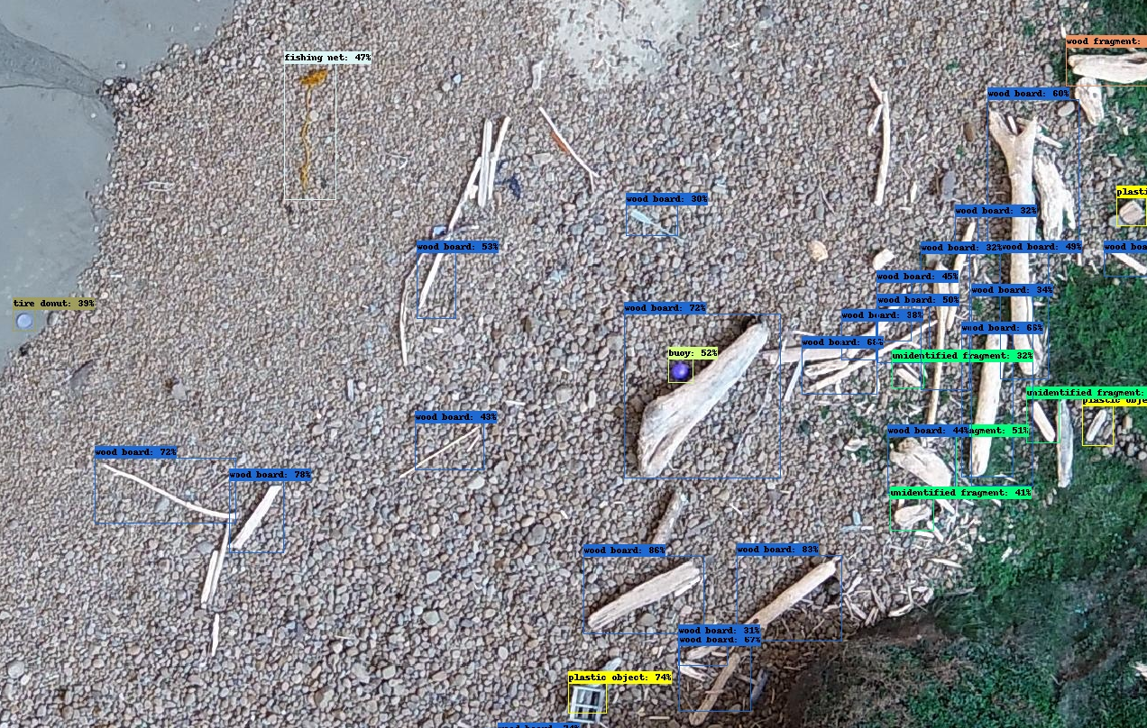
Marine debris is a global issue that threatens our environment, navigation safety, coastal economies, and potentially human health. NOAA and partners are exploring new methodologies for locating, classifying, and counting large (>20 cm) shoreline-stranded marine debris objects using aerial imagery and machine learning.
Using source high-resolution aerial imagery collected in Hawaii in 2015, the research team assembled a data set of labeled shoreline marine debris objects. This data set — consisting of 5,733 hand-labeled marine debris objects spread across 1,224 aerial image chips — was used to train a deep learning-based object detection model.
The team used this deep-learning model to develop a prototype application which allows users to upload their own high resolution aerial imagery, and receive actionable information about potential marine debris in each image, including material type, distribution, and quantity. Information gleaned from this application can be used to create heat maps to inform marine debris rapid response and removal efforts.
The trained model, associated code, and data are available to the public on TensorFlow, a free and open-source software library for machine learning and artificial intelligence, which will allow future machine learning researchers to build upon the team’s work.
These open source data, machine learning models, and end-user applications are a critical first step to stimulate research and adoption of machine learning for the management of marine debris. An upcoming field mission in Texas will help test how well the model performs in a new region. This work is part of a collaborative project by NCCOS, NOAA Marine Debris Program, Oregon State University (OSU), and ORBTL.AI to explore the use of Unmanned Aerial Systems (UAS) to accurately and quickly detect and identify marine debris.