 An official website of the United States government.
  Official websites use .gov
A .gov website belongs to an official government organization in the United States.
Official websites use .gov
A .gov website belongs to an official government organization in the United States. Secure .gov websites use HTTPS
A lock or https:// means you’ve safely connected to the .gov website. Share sensitive information only on official, secure websites.
Secure .gov websites use HTTPS
A lock or https:// means you’ve safely connected to the .gov website. Share sensitive information only on official, secure websites.We are using modeling to identify the best locations along the Texas Coastal Bend where natural and nature-based features (NNBF) can be used to address the effects of sea level rise and storm surge.
Why We Care
The Coastal Bend of Texas includes eleven coastal counties encompassing the Corpus Christi metropolitan area and is characterized by a system of barrier islands, lagoons, and estuaries on a broad coastal plain. The region's low elevation, land subsidence, small estuarine tidal ranges, and exposure to hurricanes make the area vulnerable to sea level rise. To protect the region's growing economy, communities need information on the impacts of future sea level rise and the effectiveness of natural and nature-based features (NNBF), which can mitigate coastal risk while offering a variety of additional benefits.
What We Are Doing
This project aims to:
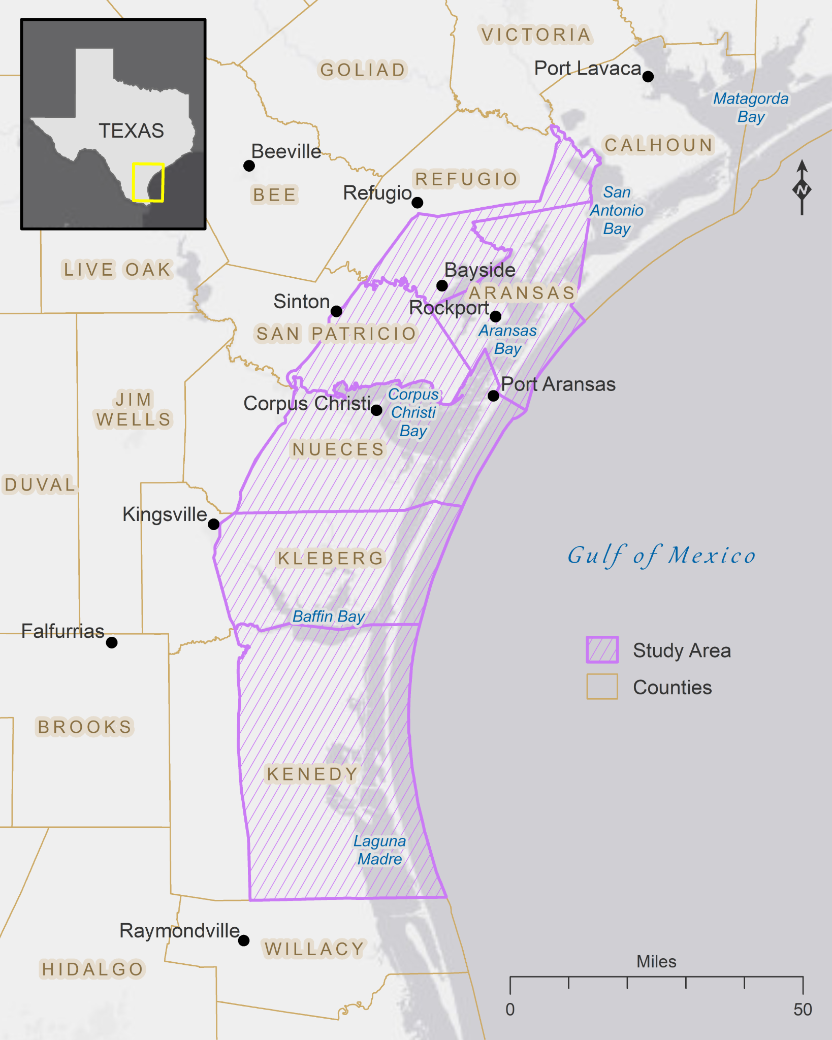
The Texas Coastal Bend region and the project study area. Credit: J.C. Gibeaut, Texas A&M University.
-
-
- Improve and adapt the existing coupled hydrodynamic-marsh model (Hydro-MEM) to the Texas Coastal Bend,
- Assess sea level rise vulnerabilities and NNBF efficacy using the Hydro-MEM and the Sea Level Affecting Marshes Model (SLAMM), as appropriate, and
- Form a collaborative Management Transition Advisory Group (MTAG) to produce a knowledge base for modeling and assessing sea level rise resiliency in the region.
-
Within these goals, the project will determine which locations in the Texas Coastal Bend are best suited for NNBF to address sea level rise and improve resilience. This will involve engaging stakeholders to explore how local sea level rise impacts human activities and the efficacy — and practicality — of various NNBF to create more resilient conditions.
Local variation across the region means various NNBF scales and approaches are needed, including using multiple lines of defense against sea level rise. The project team will make such determinations by modeling the effects of sea level rise and future hurricane surges, with and without implemented resiliency strategies.
To enable this analysis, the team will improve and adapt (e.g., through extension to mangrove habitats) the Hydro-MEM model to the study. The quality of the sea level rise assessments will be enhanced with an innovative and improved use of soil-surface Digital Elevation Models in coastal vegetation, which are documented as essential for assessing microtidal habitats. Further, the project will collaborate with an MTAG that includes representatives from local, regional, and state groups involved in coastal resiliency planning, from both the public and private sectors.
Benefits of Our Work
The project will significantly improve existing sea level rise models, including Hydro-MEM and SLAMM, by enhancing the input to those models and tailoring them to local scenarios and needs. The project will also improve stakeholder and end user understanding of sea level rise vulnerability along the Texas coast.
The specific tasks of the MTAG will be to help project leads build relevant sea level rise scenarios for the Coastal Bend and assess the effectiveness of solutions, including those that use NNBF. The MTAG will work closely with project leads to determine what end users need and which solutions to test in the models. A broader set of project partners (e.g., property owners, developers, academics. local government representatives, and citizen advisory groups) will also be involved to ensure the input MTAG is providing resonates with the broader group of stakeholders along the Texas coast.
Over the course of the project, MTAG members and project partners will gain a greater understanding of and familiarity with the sea level rise models, improving their knowledge on how to use and apply the models, and how and why they can and should be used to improve decision-making.
The improved model outputs will also help enhance the Texas Coastal Resiliency Master Plan led by the Texas General Land Office. The plan assesses issues of concern involving natural coastal environments and vulnerabilities of Texas communities to coastal hazards, including sea level rise.
The project is led by Dr. James Gibeaut of the Harte Research Institute (HRI), Texas A&M University – Corpus Christi (TAMUCC). Co-investigators include Drs. Katya Wowk (HRI/TAMUCC), Denise DeLorme (Louisiana State University), Lihong Su (HRI/TAMUCC), and Peter Bacopoulos (Louisiana State University). The project is part of NCCOS's Effects of Sea Level Rise Program (ESLR) Program.