Salt marshes are rapidly deteriorating due to sea-level rise. The Deal Island beneficial use project, implemented in 2024, demonstrates one potential strategy for increasing the lifespan of vulnerable marshes. The restoration effort involved placing dredged material from the lower Wicomico River onto the marsh platform to increase its elevation and, as a result, enhance its resilience to future sea-level rise. NCCOS researchers, in partnership with a large, multidisciplinary project team are evaluating the benefits and impacts of this action.
Why We Care
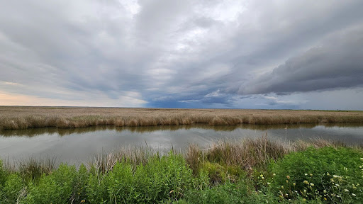
Salt marshes in the Chesapeake Bay watershed provide many valuable ecosystem services including shoreline protection, water filtration, and habitat for commercially and recreationally important foundational species, but are rapidly deteriorating due to sea-level rise. Modeled predictions of future habitat extent in the Chesapeake Bay region suggest that irregularly flooded marsh like those at the Deal Island Wildlife Management Area will all but disappear from the Bay within the next 30 years. To address this challenge, NCCOS, Maryland Audubon, the US Army Corps of Engineers, US Naval Academy and partners are developing and evaluating innovative solutions to protect and restore vulnerable marsh habitat. The site at Deal Island is particularly vulnerable as it is experiencing high rates of subsidence along with rising sea levels and offers protection to multiple historic communities on the Eastern Shore of Maryland.
What We Did/Are Doing
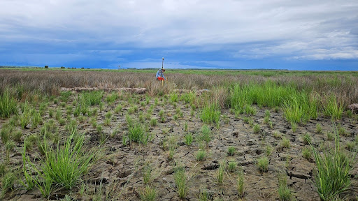
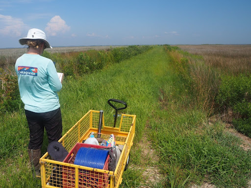
The sediment placement project at Deal Island included intensive data collection efforts prior to placement (vegetation monitoring, elevation measurements, bird species identification, sedimentation rates, and carbon stock). Those measurements set an important baseline with which to compare to conditions after placement was completed. In the winter of 2023/2024, sediment that was dredged from the lower Wicomico River to maintain navigability was pumped across the peninsula into the Deal Island WMA marsh. In some areas, the placed sediments resulted in increases in surface elevation of up to 18 inches. Placement was completed in February of 2024 and subsequent planting of native species was completed through the summer of 2024. Immediate measurements of elevation, porewater chemistry, vegetation, and sediment characterization followed by continuous monitoring of the site will help inform future projects like this that can help reduce vulnerability to coastal hazards.
Impact/Benefits of our Work –
Given the dire predictions of future marsh loss in the Chesapeake Bay region (and beyond), novel tools for marsh management are being increasingly looked to as a means of preserving marsh habitat. The beneficial use of dredged sediments has great promise as a marsh management strategy but applications like the one at Deal Island have not been well-studied. The data that NCCOS is collecting will allow for an objective assessment of the benefits and impacts of sediment placement in coastal marshes. The knowledge gained through this work will help to ensure that future beneficial use projects are designed for maximum success.