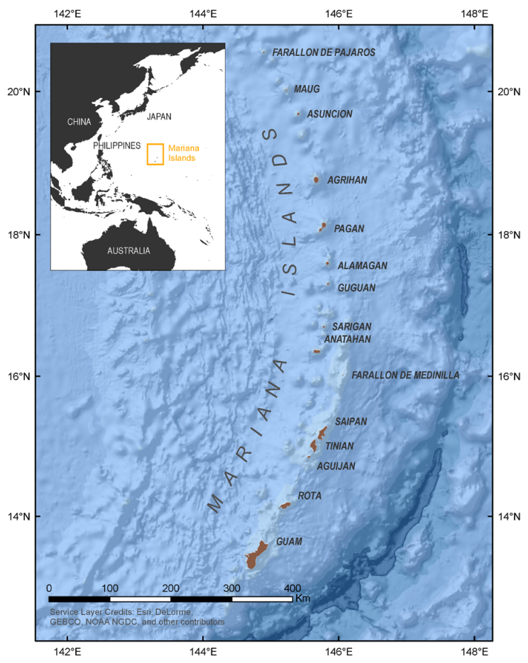
Nearshore marine areas around the Commonwealth of the Northern Mariana Islands have diverse ecosystems that provide people with seafood, recreation opportunities, and coral reefs that buffer storm surges. However, many of these areas lack the habitat mapping data needed for local officials to manage them properly. We will develop nearshore habitat maps for high-priority areas identified by local natural resource managers and other stakeholders.
Why We Care
Coastal habitats, such as coral reefs, seagrass beds, and sand flats, in nearshore areas of the Commonwealth of the Northern Mariana Islands (CNMI) support rich marine ecosystems that also benefit humans. They are home to an immense diversity of marine species, act as protective barriers to storm surges and other erosive coastal forces, attract tourists, create jobs for local people, and provide fishing grounds for food. However, increasing pressures on these coastal habitats can and have caused significant declines in their health. Some of these pressures, such as global warming and resulting ocean acidification, occur at large scales and are challenging to pinpoint locally. For other issues such as overfishing, reduced water quality from pollution and runoff, and infrastructure creation, the source of these pressures can be well known spatially. However, in either case, impacts can be monitored at a local level.
Habitat maps provide crucial information to find spatial relationships among adverse pressures, monitor impacts, and inform management decisions to maintain these coastal ecosystems. Maps not only show the location of various benthic habitats at the present time, but can serve as a baseline for the future, showing how habitats are changing over time. However, maps of these marine ecosystems in CNMI have not been created for many areas across the archipelago, while other areas have outdated maps that have not incorporated more recently available high-resolution spatial data. Without these maps, it is challenging to address where environmental problems might arise in the present or the future, or know who will be affected if marine ecosystems continue to decline and to what extent.
What We Are Doing
The high cost of mapping habitat necessitates prioritizing coastal areas based on the greatest needs and interests of local stakeholders. As part of a mapping gap analysis project in 2023, NOAA’s Coral Reef Conservation Program (CRCP) identified mapping focal areas in Tinian, Saipan, and Rota. This analysis requested information on mapping priorities for coral reef areas, in particular, for depths between 0 and 40 meters. These areas were selected by participants based on the highest ranking regions of spatial data needed for coral reef management. Additionally, the prioritization survey asked how spatial data would be used to inform coral reef management.
Based on this prioritization study, NCCOS will create maps that will depict the distribution of key benthic habitats (e.g., live coral reefs, seagrass) in these high-priority areas (Figure 1). Habitat maps will be developed using lidar data collected by USGS/NOAA in 2019–2020 and existing high-resolution multispectral satellite imagery. New underwater georeferenced videos and photos will be collected to inform habitat model and map development, and evaluate the performance and accuracy of these products. The final deliverables will include GIS-ready habitat maps and underwater three-dimensional scenes created using a photogrammetric method called Structure from Motion (SfM). These products and datasets will all be made available for access through NCEI, CORIS, and NCCOS project sites; and visualized through NCCOS web mapping services.

Benefits of Our Work
Habitat maps created by NCCOS will support coral reef management activities of the CNMI stakeholders who participated in the prioritization study. These management activities include: 1) rapid response to coastal and marine emergencies, particularly those that require immediate assessment and triage, and remediation activities for events such as storms, vessel groundings, bleaching events, disease, or invasive species outbreaks, 2) long-term biophysical monitoring, discrete management/restoration assessments, or emergency/disaster response assessment, and 3) mitigation for climate change impacts and other coastal hazards.
In addition, habitat maps will be available for addressing other environmental concerns and management decisions in these focal areas. Coastal and offshore benthic habitat maps give industry, regulators, and special interest groups environmental information to make more comprehensive planning decisions on future infrastructure such as offshore energy facilities or other local construction projects. Maps produced by this project will provide detailed information to preserve future recreational and commercial fisheries through identification of habitats used by fish. This can also be helpful to design and define the efficacy of marine protected areas, which can in turn protect both natural and cultural resources. Further, creating habitat prediction maps is beneficial to coastal tourism, whereby managers can help educate and guide tourism use on local marine ecosystems.
This work will include partnerships and feedback from NOAA’s Coral Reef Conservation Program (CRCP), Naval Facility Engineering Systems Command (NAVFAC), NOAA Pacific Islands Regional Office (PIRO), University of Guam, and CNMI territorial government agencies.
