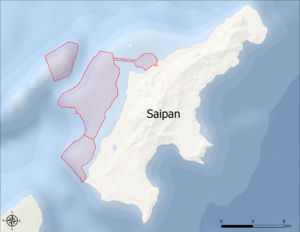
In 2019, NOAA launched the Pacific Mapping Cooperative: RICHARD (Rainier Integrates Charting Hydrography and Reef Demographics) Marianas Campaign to develop a plan to conduct much-needed mapping in the Marianas Archipelago. NCCOS was requested to generate contemporary, high-resolution shallow water benthic habitat maps for select areas off Saipan, which is the largest territory in the Commonwealth of the Northern Mariana Islands (CNMI). This effort will support coastal management, disaster response, navigation improvements, and national security interests in CNMI.
Why We Care
NOAA’s National Ocean Service (NOS) and National Marine Fisheries Service (NMFS) have proposed a collaborative Integrated Mapping Product trial to meet regional mapping needs. This project will support a NOAA collaboration between scientists and personnel from Office of Coast Survey (OCS), the National Centers for Coastal Ocean Science (NCCOS), the Pacific Islands Fisheries Science Center (PIFSC), the NOAA Coral Reef Conservation Program (CRCP), and the NOAA Ship RAINIER, to generate an integrated, benthic data product covering the benthos from 0-1000 m across the islands of Saipan, Tinian, Agujian, and associated shallow banks.
NCCOS will develop a high-quality habitat characterization map that will serve as a key component to this effort. This will allow the collaborative team to generate a nested product that will serve as the best available data on the status of benthic habitats in the Saipan region.
What We Will Do
The goal of this project is to develop benthic habitat products around Saipan, CNMI. These maps will depict the distribution of key biological and geomorphological habitats in the project region. They will be developed using existing, readily available remotely sensed data, including high-resolution bathymetry and backscatter as well as multispectral satellite imagery. Underwater georeferenced videos and photos will also be collected to inform habitat model and map development, and evaluate the performance and accuracy of these products. The final deliverables will include GIS-ready habitat maps and products, underwater videos, an online web map, and a technical report describing the methods used to develop these products.
Benefits of Our Work
This project is part of a strategic NOAA mapping campaign that includes multiple agencies and line offices that share a similar goal – to better understand submerged lands around Saipan, CNMI. Integrated data layers will allow a collaborative NOAA team to generate a product that will serve as the best available data on the status of benthic habitats in the Saipan region, will provide the foundation for ecological survey design, assess habitat structure, and support Ecosystem-Based Fisheries Management Priorities. The National Ocean Service is committed to working with the National Security Council to tackle issues related to coastal resiliency and disaster response, and the benthic habitat maps produced by NCCOS will serve as one of the distinct mapping products that will directly benefit and be of great value to this effort.