A NOAA-supported team has helped lay the groundwork for flood protection with natural infrastructure projects at Marine Corps Support Facility (MCSF) Blount Island in Jacksonville, Florida. The team worked with the facility to create a framework and guidance package that describes the steps required to develop and design restoration efforts involving beneficial reuse of dredged sediments. This work now continues with a new effort to design and obtain regulatory endorsements for up to three natural infrastructure projects for shoreline and mission resilience at MCSF Blount Island.
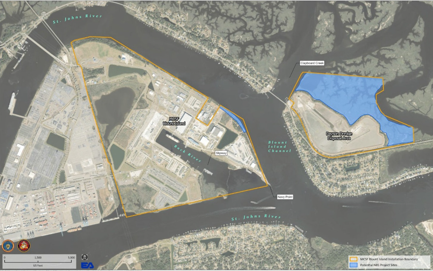
MSCF Blount Island is critical for Marine Corps readiness in combat and disaster relief. The island was created in the 1960s from dredged materials generated during the widening of the Dames Point-Fulton Cutoff shipping channel in the St. Johns River. Over time, hurricanes, vessel traffic, and rising water levels have resulted in erosion of its coastal wetlands, leaving the installation with limited options to protect the shoreline as it retreats. This collaborative effort will ensure that the base can proactively pursue solutions to enhance mission resilience against coastal hazards like storm surge and rising tides.
Proposed restoration work includes the thin-layer placement of dredged material to raise the elevation of salt marshes, which will help protect the facility’s critical infrastructure by creating new habitat and improving shoreline resilience. The project team expects to make decisions on the efficacy of the three potential projects, arrive at full design plans, and receive permits by the Fall of 2027. This current effort is funded by the U.S. Marine Corps and continues the NOAA project by building internal capacity to execute natural infrastructure projects within the DoD. It is led by EA Engineering, Science and Technology, and includes partners from MCSF Blount Island Command, UNC Chapel Hill and UGA.
This original project is part of NCCOS’ Effects of Sea Level Rise (ESLR) Program, and was led by the University of North Carolina Chapel Hill. The project team included scientists from NCCOS, the United States Army Corps of Engineers, and EA Engineering, Science and Technology. The team identified and quantified coastal hazards, collected and interpreted data to design solutions to local challenges, and built the relationships and trust necessary for this next step of the planning process. The NOAA-funded team continues to contribute to the design and process to obtain regulatory endorsements. Visit the project page to learn more about this effort.
This work is authorized by the NOAA Authorization Act of 1992, Pub. L. 102-567 (Oct. 29, 1992); sec. 201(c), which authorizes appropriation for the NCCOS Competitive Research Program. This work supports the Coastal Zone Management Act sections 1451 and 1452.