We are evaluating sea level rise vulnerability and flooding risk in combined coral and mangrove ecosystems in the U.S. Virgin Islands. Results will inform nature-based solutions, adaptation planning, and coastal management decisions that account for sea level rise and flooding impacts.
Why We Care
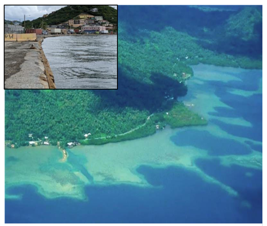
The tropics are dominated by thousands of coral reef–lined islands with shoreline mangrove forests that are expected to experience disproportionately greater sea level rise impacts in the future. Coral reefs and mangroves together provide an effective first line of defense against sea level rise and the increased flooding and wave risk brought on by rising water. Coral reefs attenuate wave energy, which results in lower-energy waves at mangrove forest fringes. Wave attenuation continues as water moves through roots and trunks of mangrove trees, increasing sedimentation that mangroves need for settlement, propagation, and maintaining their elevation relative to sea level. However, there is limited understanding of how these two ecosystems may co-evolve with sea level rise, and what this will mean for ecosystem resilience and the coastal protection they provide.
What We Are Doing
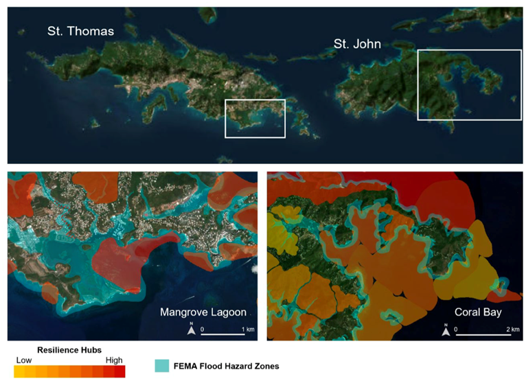
This project will use existing models to assess the vulnerability and potential nature-based solutions (NBS) approaches for two locations in the U.S. Virgin Islands (USVI): Mangrove Lagoon, St. Thomas, and Coral Bay, St. John. These areas were selected based on their high potential for NBS projects that can benefit both people and wildlife.
Researchers will combine the modeling frameworks of BEWARE, WARMER2, and XBEACH to model flooding hazards under a range of sea level rise scenarios and landscape configurations. Scenarios can include a wide variety of NBS approaches across the green-to-gray-infrastructure spectrum (e.g., mangrove–coral reef restoration, mangrove restoration–no coral reef present, coral reef–seawall, coral reef–gray infrastructure). The flooding characteristics from the simulations with coral reef and mangrove NBS will be compared to simulations with only traditional flood mitigation features, like seawalls, to understand NBS performance in flood mitigation.
Benefits of Our Work
This project aims to reduce risk and increase island resiliency of natural and cultural resources and infrastructure by providing model simulations across a range of plausible future sea level rise conditions and NBS options positing both mangroves and coral reefs as adjoined units. Coastal managers and communities can use the model outputs to inform the design of current and future management decisions, and support applications to programs that fund resilience project implementation (e.g., FEMA BRIC, NFWF NCRF). The project approach will be transferable and applicable to many tropical coral reef–lined islands and locations in the USVI.
This team is led by Dr. Karen Thorne (U.S. Geological Survey (USGS) Western Ecological Research Center), in collaboration with Dr. Curt Storlazzi (USGS Pacific Coastal and Marine Science Center), Dr. Ken Krauss (USGS Wetland and Aquatic Research Center), Dr. Kevin Buffington (USGS Western Ecological Research Center), and Dr. Michael Beck (University of California at Santa Cruz), and is funded through the NCCOS Effects of Sea Level Rise (ESLR) Program.