Oysters reefs are considered one of the most imperiled marine habitats due to overfishing, disease, and habitat destruction. Working with resource managers from North Carolina to Florida, we are developing novel approaches using uncrewed aerial systems (i.e., drones) to monitor and assess the condition of intertidal oyster reefs. Ultimately, the approaches we develop will better inform management and restoration of the resource.
Why We Care
Oysters and the reefs they form provide some unique management challenges. On one hand, they support culturally and economically important commercial and recreational fisheries. On the other hand, they improve water quality as they filter feed, form habitat for themselves and many other organisms, and protect our shorelines from erosion. However, following more than a century of harvest in combination with other stressors such as disease, oyster reefs are considered one of the most imperiled marine habitats.
What We Are Doing
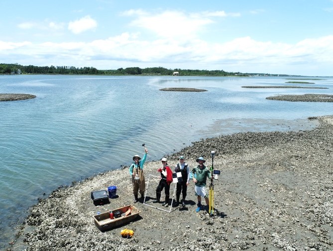
To better manage and restore oyster reefs, managers and restoration practitioners have expressed a need for affordable, non-destructive approaches to rapidly and quantitatively assess oyster reef condition.
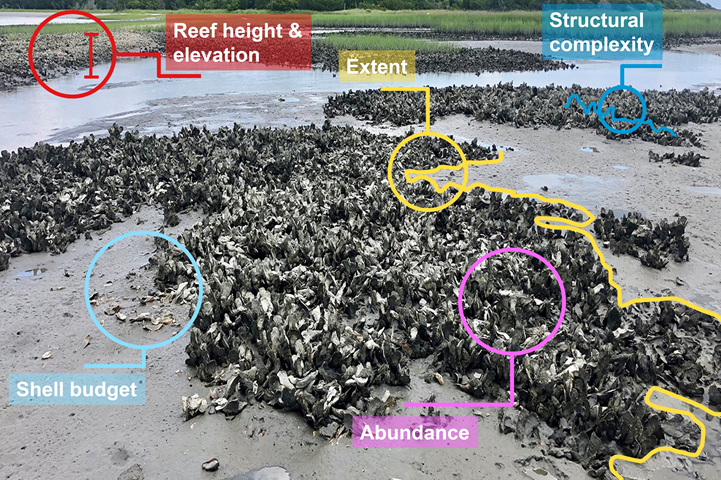
Priority metrics identified by managers and practitioners for assessing oyster reef condition include (see oyster reef photo below):
-
- Reef Height and Elevation: a key determinant of distribution and abundance of intertidal organisms such as oysters
- Extent: the two-dimensional reef area
- Structural Complexity: the three-dimensional structure of the reef, including interstitial spaces, that serves as habitat
- Shell Budget: shell is the “currency” of the reef with loss terms due to, for example, removal of shell via harvest and gain terms due to, for example, recruitment of juvenile oysters or addition of shell via restoration
- Abundance: the number and size distribution of oysters on the reef.
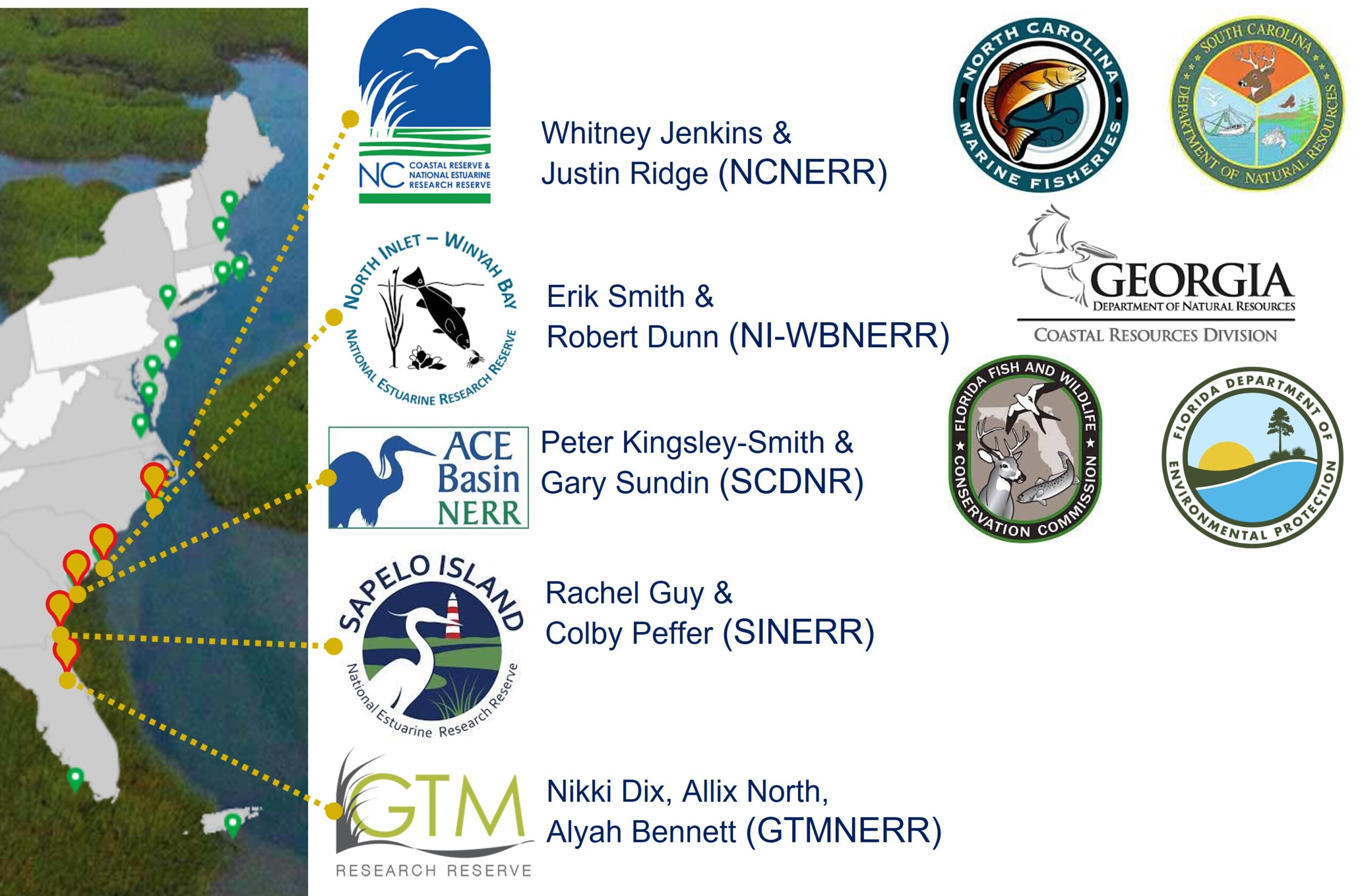
The goal of this project is to conduct a regionally coordinated effort along the southeast coast of the US to determine the ability of data derived from uncrewed aerial systems (UAS, aka drones) to estimate metrics associated with oyster reef condition. To do so, we will work with five National Estuarine Research Reserves (NERRs) and resource management agencies from North Carolina to Florida. We are working with staff from North Carolina, North Inlet-Winyah Bay, ACE Basin, Sapelo Island, and GTM NERRs. Project partners from state resource management agencies include the North Carolina Division of Marine Fisheries, South Carolina Department of Natural Resources, Georgia Department of Natural Resources, Florida Fish and Wildlife Conservation Commission and Florida Department of Environmental Protection (see bottom picture with project partners).
Benefits of Our Work
Anticipated benefits include improved interstate collaboration supporting enhanced oyster management and restoration, and enhanced technical capacity for resource managers to conduct UAS-based oyster reef assessments. Ultimately, this information will be used to inform allocation of scarce resources, such as shell for fisheries enhancement or restoration, as well as managing recreational and commercial harvest activities.
Next Steps
-
- UAS Workflow. We will develop a workflow for UAS-based data collection, management, processing, and analysis for measuring priority oyster reef metrics (see list above) and assessing change in those metrics over time.
- Data Products and Analysis. Implementation of the UAS workflow will generate several products and analyses to meet the needs identified by our project team. These include orthomosaics (composite of individual images “stitched” together) and digital elevation models (a 3-D representation of the reef terrain), UAS-based measures of reef condition metrics, between UAS and in situ measures of reef condition metrics, and change analysis to quantify the impacts of harvest (shell removal) and restoration (shell addition) on reef .
- Communications and Outreach. A workshop will be held to train any interested oyster resource managers in UAS-based data collection, processing, and analysis.