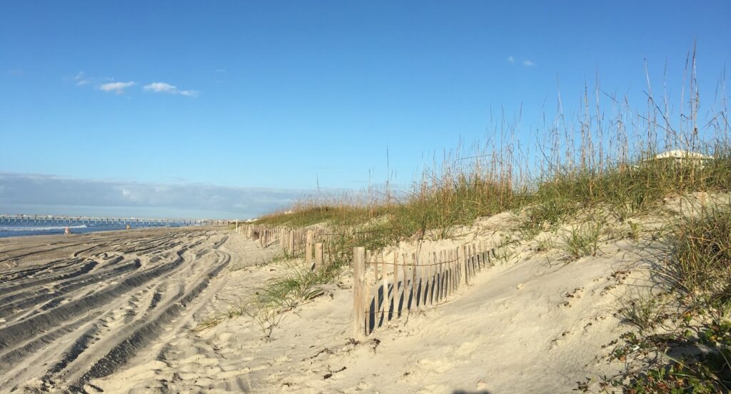
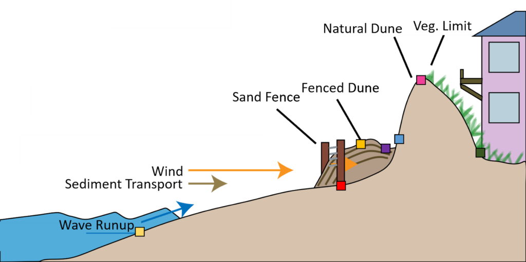
Sand fencing on a beach or dune can help trap sands and assist in building a new foredune in front of a natural dune, to provide additional protection against coastal erosion and flooding (Figure 1). However, a recent NCCOS-supported study demonstrates that sand fencing in the foredune may not always be the best singular management action. While sand fences can trap sand and increase dune width at the base of the fence, they can also prevent sand deposition to the natural dune behind the fence, reducing vertical growth of the natural dune. This study highlights the complexity of the nearshore beach and dune system.
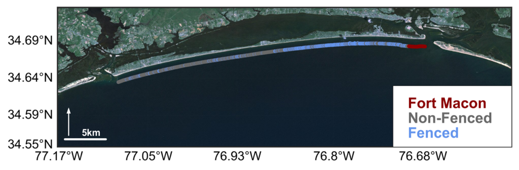
Scientists from the University of North Carolina at Chapel Hill and Oregon State University, monitored sand dunes on Bogue Banks, NC, over a 20-year period from 1997 to 2016, using LiDAR-derived cross-shore transects to measure beach and foredune features (Figure 2). Sand fences were placed along parts of the island in 2010, allowing for comparison of sites with and without sand fencing.
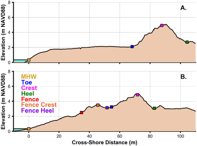
The team found that natural foredunes located behind fenced dunes were typically shorter, wider, and had a smaller total volume of sand when compared to unfenced natural dunes. Although this may partly be due to a tendency for fences to be installed in front of more vulnerable dunes in developed areas, the results suggest that sand fences prevent growth of the landward dune behind fenced dunes (Figure 3).
The lower and wider dune system created by sand fencing has implications for how storms may impact areas with sand fences. The lower elevation of the crest of the primary dune makes it more susceptible to being overtopped by waves and the water level during high water events. Overtopping allows water to reach areas behind the dune, also known as overwash or inundation, potentially causing damage to the dune and homes. However, the increased width of fenced dunes increases the lateral distance of the dune that can be eroded through before the dune system is breached and fails. This means that for storm events with lower water levels, but that last a long time, sand fencing would be an asset.
As is the case in all coastal management decisions, decisions should be site-specific and sand fencing should be considered as one of multiple potential tools. Continued evaluations like this one, that help inform combinations of dune management actions, will be needed to help decision makers make informed decisions about how to best protect coastal communities.
For details regarding the study, see Michael Itzkin, Laura J. Moore, Peter Ruggiero, Sally D. Hacker. 2020. The effect of sand fencing on the morphology of natural dune systems. Geomorphology, 352; https://doi.org/10.1016/j.geomorph.2019.106995.
This study was supported in part by the NCCOS Effects of Sea Level Rise (ESLR) project “The Coastal Recovery from Storms Tool (CReST): A Model for Assessing the Impact of Sea Level Rise on Natural and Managed Beaches and Dunes.” The project is led by Professor Peter Ruggiero of Oregon State University, along with co-PI’s, Professor Laura Moore of the University of North Carolina at Chapel Hill, and Professor Sally Hacker of Oregon State University.