
Right: Placement of a piezometer, which is used to measure ground water pressure, followed by three capacitance sensors to measure the location of the ground water and/or infiltration of water due to extreme precipitation. Credit: Auburn University.
NCCOS-funded researchers have published two studies that describe the performance of soil moisture sensors to monitor how flooding damages roads. Sensor data can be used to inform better pavement design and maintenance practices.
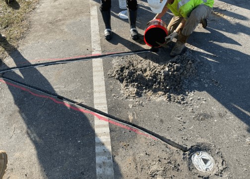
The team is monitoring moisture in the soil south of Alabama’s highway 180 on the Fort Morgan Peninsula and Bienville Boulevard on Dauphin Island. To accomplish this, the team tested and installed soil sensors below the pavement to continuously collect moisture data. Soil moisture often fluctuates both seasonally and under extreme weather events, when roads are flooded from surface or groundwater and across a range of salinity and temperature conditions. The team has now published papers that review sensor performance under varying temperature and salinity conditions and summarize the difficulties associated with the most commonly used commercially available soil moisture sensors.
The ability to accurately gather soil moisture data for soil below pavement is particularly important in understanding how moisture affects pavement performance. Long-term monitoring of the moisture of soils can allow for better pavement design and maintenance practices, which would save communities money that they would otherwise have to spend on damaged road repairs. While multiple technologies have been used to monitor soil moisture, the performance of those sensors often varied in situations where salinity varies, like at the coast. The team’s last study, captured in this review paper, summarizes the difficulties associated with commonly used, commercially available soil moisture sensors.
The data collected from this project is available to the project team in real time. With data in hand, the team is using hydrological and pavement models to understand the impacts of groundwater fluctuations and sea level rise on infrastructure performance. This work accompanies another study the team led in testing the sensors prior to deployment in the field.
The project is led by Dr. Benjamin Bowers of Auburn University with co-investigators Jose Vasconcelos (Auburn University), Robert Holmes (Auburn University), Bret Webb (University of South Alabama), Daniel Wright (University of Wisconsin-Madison), J. Brian Anderson (Auburn University), and Frances O’Donnell (Auburn University). The project is part of NCCOS’ Effects of Sea Level Rise Program (ESLR) Program; visit the project page to learn more about this effort.
Citation: Diekmann, A. 2023. Soil moisture sensing in saltwater: a review. Environmental Earth Sciences, 82. 10.1007/s12665-023-11188-4. https://www.proquest.com/docview/2866957618?pq-origsite=wos&accountid=28258&sourcetype=Scholarly%20Journals
Citation: Diekmann, A., Bowers, B.F., and Anderson, J.B. 2023. Comparison of two dielectric sensors in coarse-grained soils of increasing salinity. International Journal of Geotechnical Engineering, V. 17, Issue 7-10. https://www.tandfonline.com/doi/full/10.1080/19386362.2024.2314896#abstract