Home > Explore News > Researchers Determine Flood Risk for 13 Coastal Counties in Northern Gulf of Mexico

Researchers Determine Flood Risk for 13 Coastal Counties in Northern Gulf of Mexico

Published on: 05/03/2022
Primary Contact(s): trevor.meckley@noaa.gov

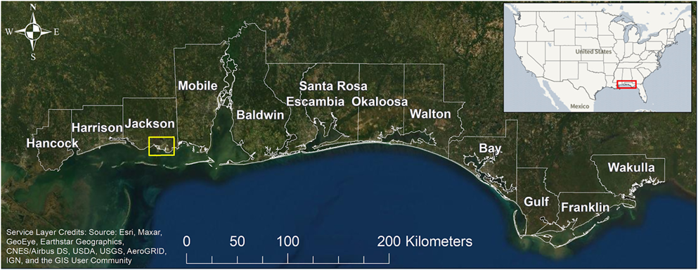
Coastal communities need to know what actions to take to mitigate flooding, now and in the future as sea level rises. A new NCCOS-funded study helps meet this need by quantifying flood risk across 13 coastal counties in Mississippi, Alabama, and the Florida panhandle.

Map of the study area along the Northern Gulf of Mexico coast. The yellow box is the inset shown in Figure 1.

Map of the study area along the Northern Gulf of Mexico coast. The yellow box is the inset shown in Figure 1.

A map example of the project’s storm surge model resolution, where data are predicted at each black dot, for census blocks in the Pascagoula area of Jackson County, Mississippi.

Figure 1. An example of the project’s storm surge model resolution, where data are predicted at each black dot, for census blocks in the Pascagoula area of Jackson County, Mississippi. Each census block (in blue) typically represents a few hundred residents. Census blocks are the smallest spatial unit by which the U.S. Census Bureau tabulates data.

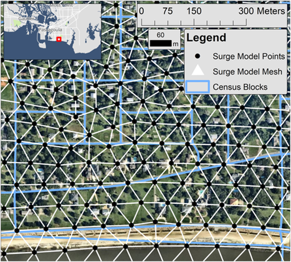
The researchers used geophysical (water levels, currents, and waves) and socioeconomic data to model impacts to coastal communities under various sea level rise scenarios. Model outputs, reported at the census block level, identify residential building damage, populations of displaced people, and populations of people requiring long-term shelter.

Study results will help coastal managers and emergency planners better understand current and future flood risk, especially for locations outside the existing floodplain where flood insurance may be optional. The findings will also inform the type and scale of flood protection measures needed for an area that contains 3,000 miles of open coast shoreline, a dozen bays, major rivers, and extensive coastal infrastructure, including a large tourism industry.

The NCCOS Effects of Sea Level Rise (ESLR) Program provided funding for the study, which was led by scientists from Louisiana State University, the University of Georgia, and the Harte Research Institute at Texas A&M University–Corpus Christi.

Explore Similar News

About NCCOS

NCCOS delivers ecosystem science solutions for stewardship of the nation’s ocean and coastal resources to sustain thriving coastal communities and economies.

Stay Connected

Sign up for our quarterly newsletter or view our archives.

NCCOS Multimedia

Visit our new NCCOS Multimedia Gallery. 

Follow us on Social

Listen to our Podcast

Check out our new podcast "Coastal Conversations"