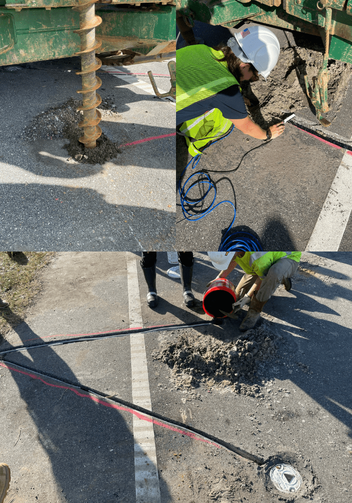
Top right: Placement of a piezometer followed by three capacitance sensors to measure the location of the ground water and/or infiltration of water due to extreme precipitation.
Bottom: Well caps placed over the soil moisture sensor holes. The two types of soil moisture sensors – time domain reflectometry and capacitance sensors – are used to measure moisture content in different ways, along with wiring that extends off the shoulder to a data acquisition box for recording data.
If you are driving down AL-180 and see a crew drilling holes in the middle of the road, you may not immediately think the goal is to protect the road. But researchers, in partnership with the Alabama Department of Transportation, are trying to do just that.
Moisture sensors installed below the pavement will help improve understanding of how rising sea levels are damaging roads, and what can be done about it. The sensors will continuously collect data as the moisture content below the pavement fluctuates, both seasonally and under extreme weather events when roads are flooded from surface or groundwater (Figure 1). This effort is part of a larger project funded by NCCOS and the Federal Highway Administration to evaluate the effects of rising seas on road infrastructure in coastal Alabama, and evaluate opportunities for natural and nature-based features to mitigate impacts to roads while accomplishing other social, ecological, and economic co-benefits that are not offered by conventional engineered flood structures.
Not enough is known about the impacts of sea level rise and precipitation on pavement deterioration, or how hardened infrastructure or nature-based approaches might best protect them. More research is needed on each of these aspects to inform decisions on how to best protect our coastal roadways and achieve complimentary benefits. This understanding is especially important for roads in coastal Alabama that have not been designed to tolerate water-based stressors, like full saturation due to an extreme precipitation event, and will be transferable along similar coastal regions around the U.S.
In addition to the moisture measurements, throughout the project a special instrumented van drives the road up to eight times per year, collecting distress data and capturing images of the pavement surface to characterize distress and deterioration overtime and as a result of overtopping events. Pavement distress data will be paired with the moisture information pre- and post- weather event to understand the effects of water on pavement deterioration. This data, combined with other project objectives, will improve understanding of surface transportation vulnerability to sea level rise and help identify management strategies to increase long term coastal transportation infrastructure resilience.
This project is led by Dr. Benjamin Bowers of Auburn University with co-investigators Jose Vasconcelos (Auburn University), Robert Holmes (Auburn University), Bret Webb (University of South Alabama), Daniel Wright (University of Wisconsin-Madison), J. Brian Anderson (Auburn University), and Frances O’Donnell (Auburn University). This project is part of NCCOS’s Effects of Sea Level Rise Program (ESLR) Program; find out more about the project here.