This two-year project is determining the economic value of the reduction in storm impacts to coastal communities due to the presence of natural infrastructure in the region associated with the North Carolina’s Sentinel Site Cooperative and National Estuarine Research Reserve. The results will provide an understanding of the impacts of storms on coastal communities, which will allow area managers to express the importance of natural infrastructure in economic terms to those communities.
Why We Care
Conserving coastal places provides economic benefits to local communities. Understanding how a community values its resources and the economic potential of stabilizing and restoring a coastal place’s natural infrastructure is key for justifying an investment in continued protection and restoration.
What We Are Doing
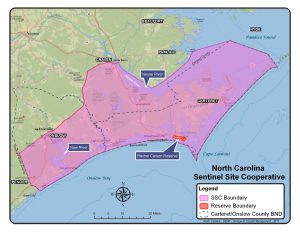
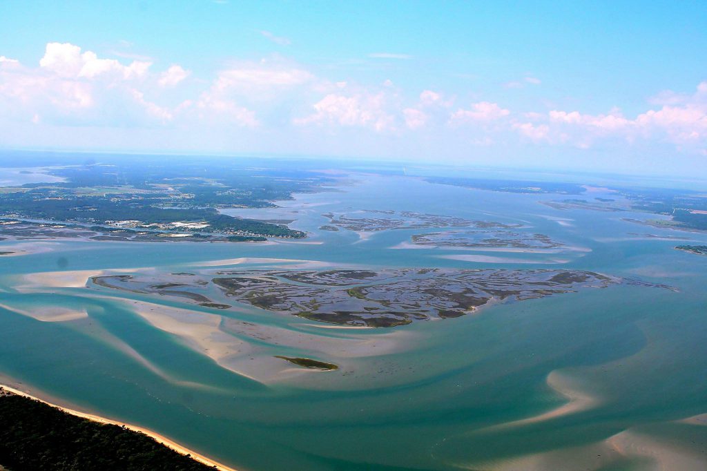
Managers of the North Carolina Sentinel Site Cooperative (NCSSC) and the North Carolina National Estuarine Research Reserve (NC NERR) are interested in an economic assessment of their natural infrastructure. The region possesses important ecological habitats, such as wetlands, seagrass beds, and dunes, and is in close proximity to coastal development, with towns in and adjacent to the NCSSC and the NC NERR. We are estimating the storm damage reduction benefits provided by natural habitats to areas in and around the region that are vulnerable to impacts from climate change and hazardous natural events. This is being accomplished, first, by identifying and mapping the current area, extent, and type of shoreline habitats as well as lands vulnerable to environmental threats (e.g., storm surge and sea level rise). NCCOS will then estimate the level of storm damage reduction that is provided to property owners and the built environment by existing shoreline habitats. Finally, researchers will calculate the value of damages avoided to coastal communities due to the presence of natural infrastructure with regard to storm surge, marsh migration, and sea level rise. With the modeled output, additional analyses may help determine locations for green infrastructure projects to increase coastal communities’ resilience to future environmental disturbances.
We are collaborating with the staff at the North Carolina Sentinel Site Cooperative, the North Carolina National Estuarine Research Reserve, North Carolina Sea Grant, City of Jacksonville, and the National Estuarine Research Reserve System.
Impact/Benefits of our Work
Local planners and natural resource managers can incorporate the ecosystem service value of shoreline habitats into planning scenarios for future development, siting new living shoreline or marsh restoration projects, and estimating the value of protection provided to important cultural resources due to the presence of shoreline habitats. These efforts will allow communities to be better prepared for climate and coastal hazard impacts such as sea level rise, erosion, flooding, and storm surge.