This project will improve the effectiveness of existing NOAA and partner Sargassum detection and forecasting capabilities, facilitate a better understanding of biochemical impacts associated with inundation or beaching events, and foster the autonomous and routine delivery of timely and accurate Sargassum nowcasts, forecasts, and warnings. Improved monitoring and forecasting systems are critical to the management of Sargassum inundation events.
Why We Care
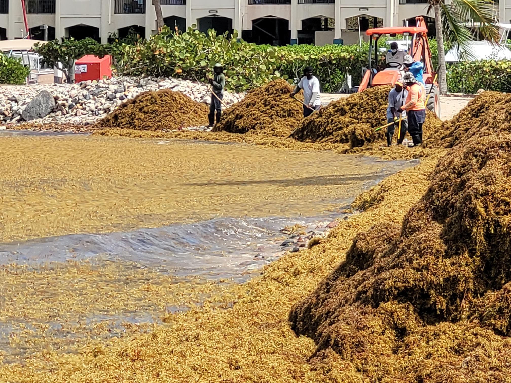
U.S. coastal communities in the Southeast and Caribbean region have been plagued by increasingly severe beaching events or inundations of floating macroalgae (Sargassum sp.). Sargassum inundation events are considered harmful algal bloom (HAB) events as large amounts of Sargassum can have devastating impacts on coastal ecosystems and economies. As large aggregations of Sargassum biomass become entrained in nearshore waters or wash up onto the coastline they can shade or smother benthic organisms, decay and release foul odors and hydrogen sulfide that can cause respiratory distress, and degrade water quality and key coastal habitats. Communities plagued by Sargassum inundations have limited and costly cleanup options, can experience drinking water shortages and other critical infrastructure impacts caused by clogged water intake pipes, and can face lasting disruptions to tourism-based economies.
What We Are Doing
Our goal is to help minimize the impacts of Sargassum on coastal communities by improving access to timely and accurate information about current and forecasted conditions and providing coastal communities a better understanding of the potential associated risks to the environment, infrastructure, local economies, and public health.
The project team will improve existing Sargassum detection and forecasting technologies, yield a better understanding of the associated impacts of Sargassum inundation and beaching, support the autonomous delivery of improved information on current conditions and forecasts, and will engage end users and foster collaborations to ensure transition of the project outputs to management action.
The project will produce delineated, daily Sargassum distribution maps at coarse-to-fine spatial scales. Forecast trajectories will be computed for each identified Sargassum patch and estimates of biochemical impacts will be determined when inundation is predicted or observed. Improved forecast and warnings will be autonomously integrated across several distribution platforms allowing end users free access to these data passively (e.g., web distribution) or actively through customized alerts. The automated nature of the project outputs will allow for sustaining the enhanced distribution system beyond the end of the project.
The project team will regularly engage with an advisory group to identify the needs of agencies and stakeholders responsible for mitigating Sargassum impacts to help guide the development and refinement of research products and assist in identifying pathways to sustain piloted enhanced monitoring and forecasting capabilities.
Benefits of Our Work
The improved alerts will give communities in Florida, Puerto Rico, the U.S. Virgin Islands, and the wider Caribbean more time to mobilize responses and minimize the harm caused by Sargassum inundation events.
This project is led by principal investigator, Dr. Brian Barnes, University of South Florida. Co-principal investigators are Dr. Chuanmin Hu and Dr. Yonggang Liu, University of South Florida; Dr. Rachel Brewton and Dr. Brian Lapointe, Florida Atlantic University; Dr. Julio Morell, Caribbean Coastal Ocean Observing System, Dr. Sennai Habtes, U.S. Virgin Islands Department of Planning and Natural Resources; and Dr. Joaquin Trinanes, NOAA Atlantic Oceanographic and Meteorological Laboratory.
This project is supported by the NCCOS Monitoring and Event Response for Harmful Algal Blooms (MERHAB) Research Program
Partners
- University of South Florida Optical Oceanography Laboratory
- University of South Florida Ocean Circulation Laboratory
- Florida Atlantic University – Harbor Branch Oceanographic Institute
- Caribbean Coastal Ocean Observing System
- U.S. Virgin Islands Department of Planning and Natural Resources, Division of Fish and Wildlife
- NOAA AOML