Coastal communities are increasingly vulnerable to climate effects, such as sea level rise and coastal erosion. To address these and other changing coastal risks in Los Angeles County, NCCOS researchers extended their Integrated Vulnerability Assessment Framework to this densely populated and highly urbanized region, coupled with further spatial and economic analyses. This work provides information to better protect, advance, and manage climate change impacts within local communities.
Why We Care
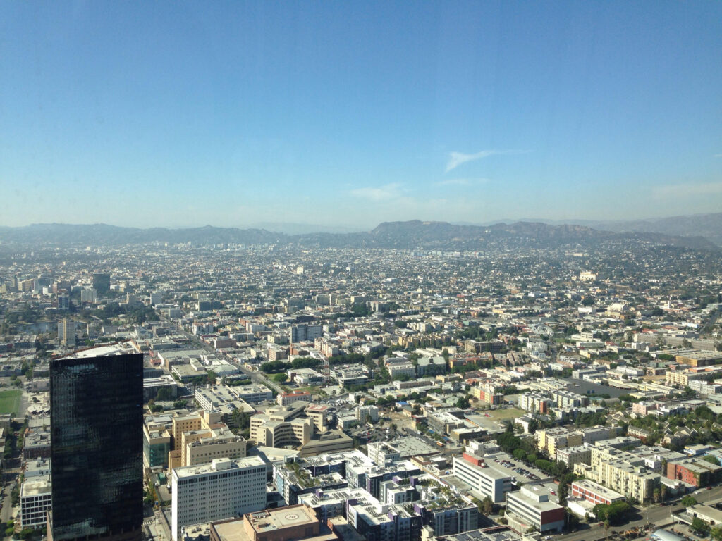
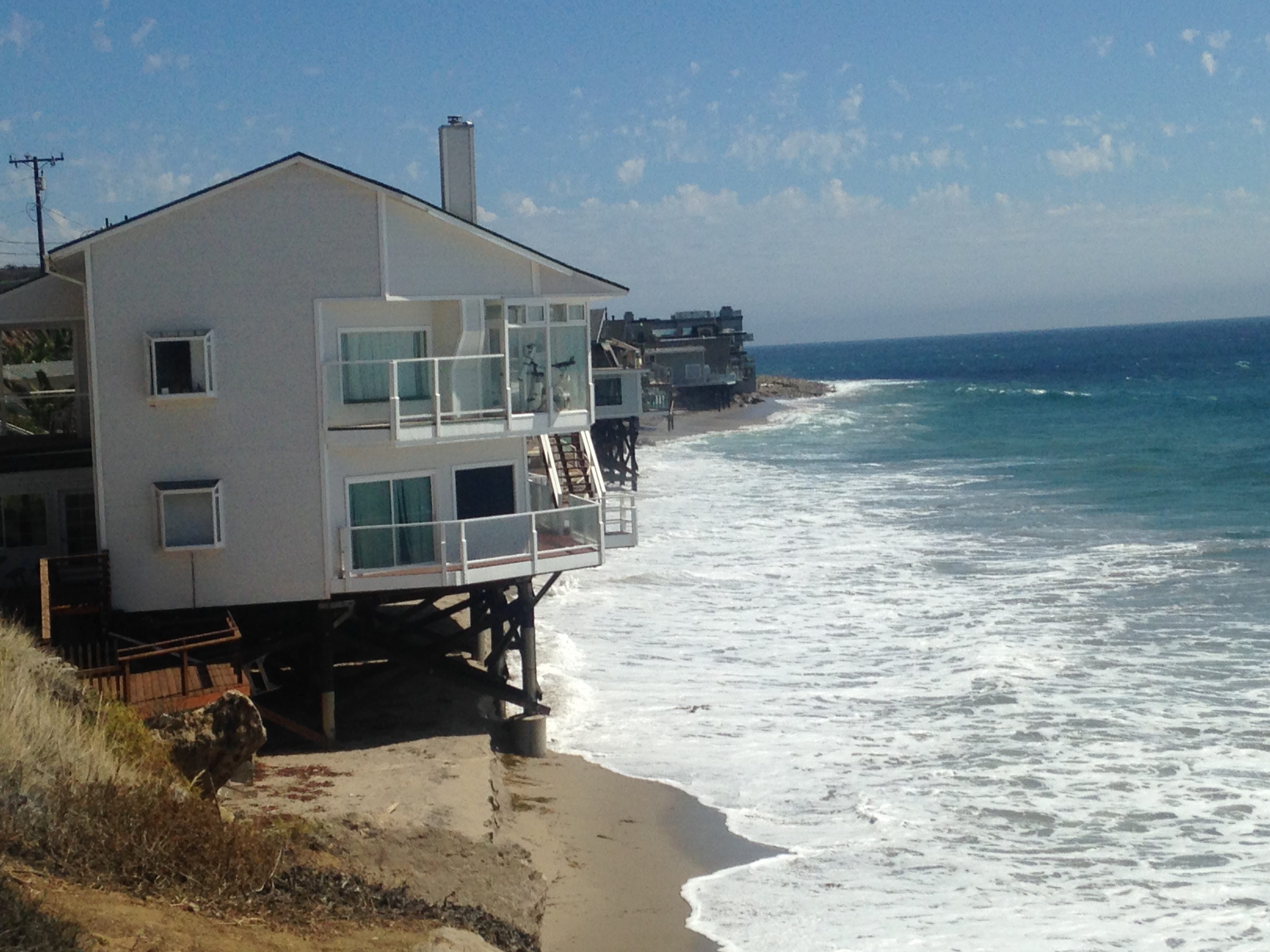
Los Angeles County is a highly complex area. As one of the nation’s largest and most populated counties, with 4,084 square miles and approximately 10 million residents, its geography, ecology, and communities are highly variable, as are its climate impacts and risks. The county is impacted by a variety of threats, such as bluff erosion, sea level rise, wildfire, saltwater intrusion, wave-driven run up, earthquakes, and tsunamis, as well as concerns over water availability, water quality, and air quality. Similarly, Los Angeles County faces extreme variation in social and economic factors, including disparities in income, education, and employment opportunities. This study examined these complexities across the county to inform decision making within the region.
What We Are Doing
To address vulnerability to climate effects and coastal risks in the study region, we first adapted NCCOS’s Integrated Vulnerability Assessment Framework to Los Angeles County. The Framework measures social, structural, and natural resource vulnerability and intersects those with coastal risks to identify areas of high vulnerability and high risk. Integration of a wide range of vulnerability and risk profiles enables users to more easily understand the complexities of overall vulnerability and risk within their region. The Framework was developed for the Town of Oxford and Talbot County in Maryland, and was then extended to NOAA’s Choptank Habitat Focus Area in the Chesapeake Bay region. In both applications, local stakeholders identified coastal and stormwater flooding as risks of highest priority. In Los Angeles, however, partners and stakeholders identified additional climate risks to incorporate, such as erosion and wildfire.
Phase I of this project:
1) Developed location-specific indicators for social, structural, and natural resource vulnerability;
2) Identified local coastal risks of most concern and their impacts;
3) Intersected base condition vulnerabilities with identified coastal risks; and
4) Identified areas of high risk and high vulnerability for further analysis.
Phase II used areas and priorities identified in Phase I, in concert with local expert knowledge and stakeholder engagement, to analyze further geographic variability within a specified coastal zone through exploration of flood insurance, access to green and cultural space, and further erosion and flooding impacts.
This project relied on partnerships with University of Southern California Sea Grant and NOAA’s Office for Coastal Management (West Coast Region).
What We Found
In Los Angeles County, the Framework integrated social, structural, and natural resource vulnerability components with coastal flooding, stormwater flooding, erosion, drought, heat, and wildfire risk for three assessment geographies: the County, urban areas, and a 10-mile coastal band. Profiles were developed for each risk and vulnerability prior to intersection and analysis. Additional analyses were conducted in the coastal band that included exploration of National Flood Insurance Program claims, access to green and cultural space, impacts of erosion and flooding on critical infrastructure, and the relationship between erosion and blufftop development. A full account of project findings can be found in our technical report, linked below, but some highlights include:
-
- Areas of high flood risk have fewer insurance claims – National Flood Insurance Program claims within 10 miles of the coast mostly occur in the northwestern region, despite flood risk being higher in south central L.A. This is perhaps driven by high erosion risk in the affected region. Further, south central L.A. has pockets of lower property values, lower claims paid out, and higher social vulnerability.
- At-risk populations and areas lack green space – Within 10 miles of the coast, there is an uneven distribution of green space, with clusters of high social vulnerability and low greenness. These clusters also overlap with areas of moderate to high combined flood risk (coastal and stormwater).
- Wildfire threatens rural and newly suburban areas – Wildfire risk is highest in rural areas, and is especially threatening to people and structures along the interface between natural and urban areas. Development boundaries have steadily expanded into historically natural areas that used to experience periodic burn events. Drought and extreme heat increase the risk of wildfire in these already at-risk areas.
- Overlapping vulnerability and risk presents opportunity – Areas that share multiple vulnerabilities and/or risks create the need for adaptation action in the face of a changing climate, but they also present an opportunity to develop and implement innovative strategies that mitigate multiple concerns across multiple sectors at once.
Benefits of our Work
Both phases of this project provide invaluable science to decision makers, planners, and partners that will inform management decisions. Without these types of analyses, coastal communities and their economies are at a disadvantage in the face of climate change and related impacts. This work provides information to better protect, plan for, and manage climate and coastal impacts within Los Angeles County and its local communities.