Communities in the U.S. Virgin Islands (USVI) experience flooding, storms, and other climate-driven hazards. Impacts from these events are felt differently across the territory and some communities feel these impacts more than others. Through our Community Risk Assessment Portfolio, we worked with local partners to assess community climate risk in the USVI.
Why We Care
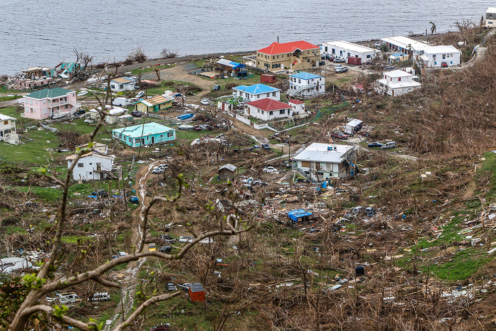
Communities on small islands with large coastal zones often rely heavily on their coastal environments. These areas are also more likely to face severe and persistent weather events, such as hurricanes that cause storm surge, coastal flooding, and damaging winds. The damage caused by acute storm events as well as more frequent flooding episodes from high tides and heavy rains make it harder for local communities to recover from and prepare for the impacts of climate change.
In the USVI, the islands of St. Croix, St. Thomas, and St. John are frequently impacted by tropical storms and hurricanes, such as with Hurricanes Irma and Maria in 2017, which caused catastrophic damage. These islands need risk indices that provide information at local resolutions to inform climate adaptation action and decision making.
What We Did
Through our Risk Assessment Portfolio, each year we identify one community or region and work with local partners and their stakeholders to assess community climate risk. Using our site selection criteria, we selected the USVI for the Portfolio’s first programmatic assessment. Our research approach includes the following steps:
-
- Partner engagement
- Indicator development
- Vulnerability and hazard assessment
- Risk assessment
- Product development and release
This project relied on partnerships with the Environmental Protection Agency – Region 2, the USVI Department of Planning and Natural Resources, the University of the Virgin Islands, and NOAA’s Climate Adaptation Partnerships (CAP) program (formally known as RISA) to provide additional capacity to the territory. We worked with partners to develop detailed project goals and outcomes. This assessment identified the following within the USVI:
-
- Demographic analysis, structural exposure, and nearshore environment benefits.
- Coastal flooding, stormwater flooding, and sea level rise flooding.
- Relative risk through intersection of vulnerability/exposure and hazard profiles.
- At-risk communities or community assets in relation to chosen flood hazards.
- Three additional place-based analysis types:
- Waterborne toxins and contaminants index
- Vegetation index
- Amenity-based walkability index
Our Findings
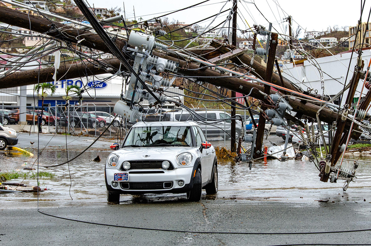
This assessment developed indicators of vulnerability, exposure, and hazard, and intersected them spatially to produce maps of risk and co-occurrence. We organized final maps by co-vulnerability, risk in relation to flood hazard, nearshore environment interactions, and other important relationships. U.S. Virgin Islands communities are at risk, overall, but some estates have higher risk than others. Some of the territory’s most vulnerable populations have increased risk of waterborne toxin and contaminant exposure, more vulnerable housing, and increased risk of flooding. Many of the territory’s industrial and waste management sites are in coastal areas at risk of flooding, and adjacent and downstream communities should exercise increased caution when flood events occur. Similarly, much of the territory’s critical infrastructure is in areas of high flood risk and also overlaps with areas of increased structural vulnerability. Since the majority of critical infrastructure services not only nearby areas but often the entire island, damage or loss of this infrastructure can have devastating effects on the territory. Areas of repeated co-occurrence suggest the need for adaptation action, but also present an opportunity to develop and implement innovative strategies that mitigate multiple concerns simultaneously.
Identified estates of co-occurrence might be candidate areas for future adaptation projects. While ideal projects depend on specific needs and technical expertise, they might include efforts to:
- Improve plumbing and kitchen facilities in estates with higher structural vulnerability.
- Update or improve critical infrastructure in estates at increased risk of flooding.
- Implement coastal gray-green hybrid solutions for improved flood mitigation in estates with reduced nearshore environment protection benefits or those at increased risk of flooding.
- Restore or increase onshore vegetation to improve natural flood attenuation in estates with limited vegetation and increased risk of flooding.
- Systematically upgrade potable water systems through pilot initiatives in estates with increased vulnerability and risk of waterborne toxins and contaminants.
- Increase greening efforts in estates with high walkability potential but lower vegetation to improve walkability.
- Increase walkability potential in estates with higher vulnerability.
Benefits of Our Work
The U.S. Virgin Islands are home to some of our nation’s most at-risk populations in harm’s way. As climate change continues, it will become even more important to provide capacity to areas of high climate risk, especially since USVI communities also depend on marine resources. Working with partners directly ensures that our results are locally tailored and relevant for effective planning. This work provides information to better protect, advance, and manage climate change impacts within the USVI.
This research identifies priority geographies that warrant further investigation for future climate adaptation and improvement projects. This assessment can also be used to inform or improve communications and outreach materials for emergency response planning, public awareness campaigns, and other purposes. Additionally, it can support grant applications by demonstrating need and advocating for climate action.