 An official website of the United States government.
  Official websites use .gov
A .gov website belongs to an official government organization in the United States.
Official websites use .gov
A .gov website belongs to an official government organization in the United States. Secure .gov websites use HTTPS
A lock or https:// means you’ve safely connected to the .gov website. Share sensitive information only on official, secure websites.
Secure .gov websites use HTTPS
A lock or https:// means you’ve safely connected to the .gov website. Share sensitive information only on official, secure websites.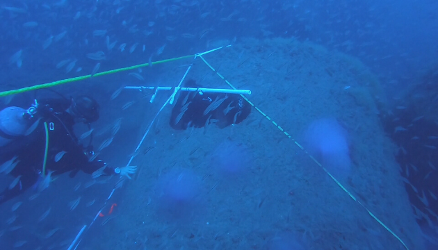
Shipwrecks and rocky reefs off the coast of North Carolina are home to commercially and recreationally important fish. Scientists with NOAA’s National Centers for Coastal Ocean Science are researching how and when fish use these artificial and natural reefs. In the fall of 2019, aboard NOAA Ship Nancy Foster, the researchers used advanced technologies to study how these reefs function as habitat.
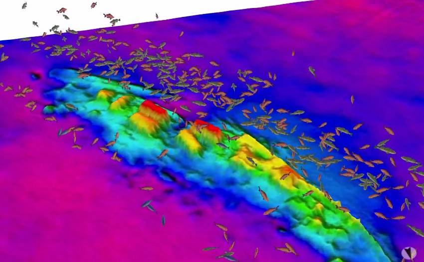
Image showing size and location of fish (acquired with splitbeam echosounder) over the wreck of the USS Schurz (acquired with multibeam echosounder). Credit: NOAA.
The team used two kinds of sonar (located on the hull of the Foster) to send sound pulses into the water that reflect off fish and the seafloor and return to the sounding device to be recorded. The multibeam echosounder registers the depth and physical properties of the reefs. The splitbeam echosounder provides imagery that helps identify the size of fish and the location of fish relative to the reefs.
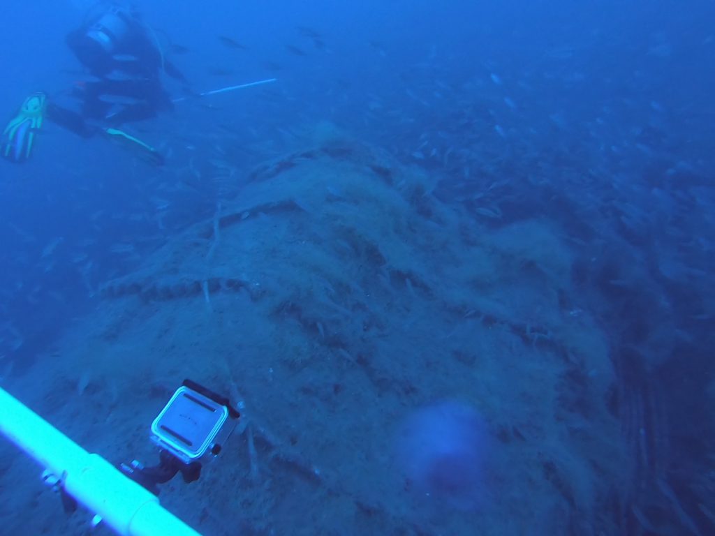
The dive team surveys the wreck of the USS Schurz, a U.S. Navy gunboat that sunk in 1918 off the coast of Cape Lookout, North Carolina, after colliding with another ship. The shipwreck footage in the video at the top of the page is also of the Schurz. Credit: NOAA.
Sonar gave the team the big picture, but for the details, the team had to go diving.
The divers collected thousands of photos along the reefs. Using Structure from Motion photogrammetry software, the team is now stitching the photos together into three-dimensional models called photomosaics, which will provide detailed pictures of the reef structures and the plants and animals living on the reefs. The divers also conducted fish surveys, identifying, counting, and estimating the sizes of all fish seen inside 5,000-square-foot sections of the reefs, about a quarter the size of a football field.
Data from the mission will help explain how shipwrecks and rocky reefs function ecologically as habitat for a variety of fish, which will inform many activities in the region, such as artificial reef enhancement programs, management of shipwrecks, and placement of proposed offshore wind energy infrastructure.