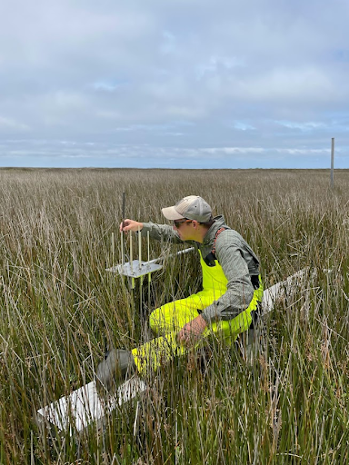
Coastal managers need information about which wetlands are most vulnerable to sea level rise in order to prioritize adaptation efforts. To support this prioritization, a “community of practice” of wetland researchers and managers met this past spring in coastal North Carolina to conduct a statewide synthesis of wetland elevation trends documented by Surface Elevation Tables (SETs). A SET is a portable mechanical leveling device for measuring the relative elevation change of wetland sediments. This data will help predict wetland resilience to current and future sea level rise, and aid in prioritization of sites for restoration.
SETs are the only tool that allow for millimeter-scale precision of elevation measures in wetlands, which is the same scale at which changes in sea level are measured. These devices have been installed in a number of wetlands across the country by various entities (academic, state and federal government, and non-governmental organizations), often to support specific, discrete research projects.
The North Carolina SET Community of Practice partners have been working together since 2018 to collect updated data from the 150 individual SETs that were installed in NC over the course of the last few decades. Collection and synthesis of this data through a holistic lens will provide for a more complete picture of wetland vulnerability to future sea level rise across the North Carolina coast than was previously possible.
To support this effort, a team of scientists and specialists from NCCOS, the U.S. Fish and Wildlife Service and NC Sea Grant traveled to Cedar Island National Wildlife Refuge in early summer 2023 to read SETs that had not been surveyed since 2015. The three SETs in Cedar Island were initially installed by scientists from the U.S. Geological Survey in 1992. With the current update, this record of elevation trends now spans 31 years and is among the longest SET records in the country, and an extremely valuable resource for understanding how wetlands are responding to changes in sea level. Combining observations from the statewide network of SETs harnesses existing resources to help coastal resource managers and planners prioritize wetland restoration sites.
