Extreme weather events and rising seas are creating more frequent flooding conditions in southwest Florida. A NOAA-funded study has supported the development of an online viewer called the Adaptation for Coastal Urban and Natural Ecosystems (ACUNE) GeoTool, which can help communities understand the potential extent and severity of future flooding in their region. Local decision-makers have codeveloped the science and asset layers for the system, and the tool is now available to the public.
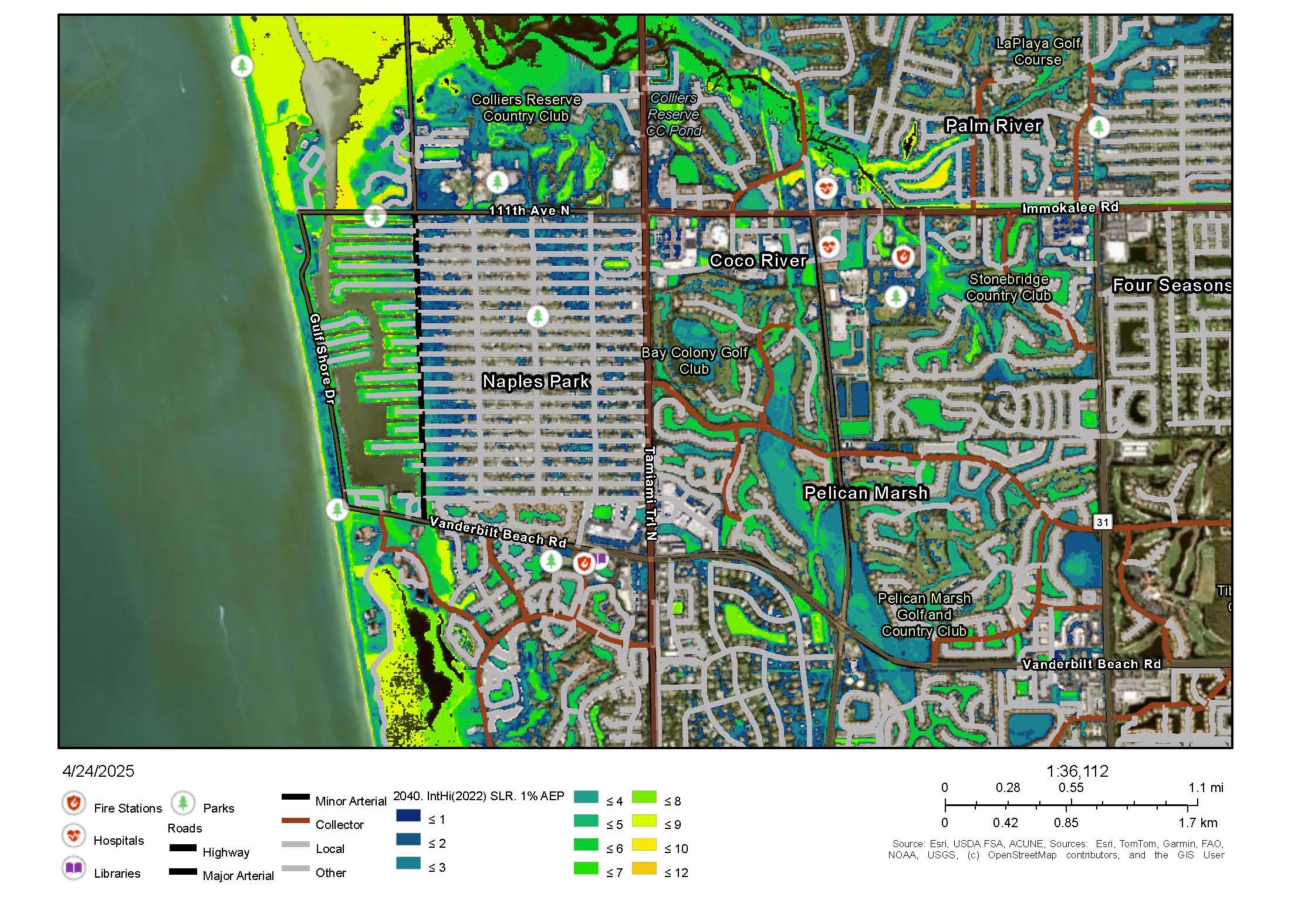
The interactive ACUNE tool employs a number of underlying models that allow users to run different flood protection scenarios and to see infrastructure and ecosystems vulnerable to sea level rise, storm surge, and urban runoff, and understand how restoration of coastal habitat may offer flood protection. The tool includes probabilistic flood maps, infrastructure maps, and potential residential structural loss for current and future scenarios, including 33 asset types — like buildings, roads, storm water facilities, hospitals, schools, and parks — and more than 50 flood layers that consider both nuisance flooding and compound flood risk to the region, including Collier County, City of Naples, City of Marco Island, and Everglades City.
Nuisance flooding, also known as high tide flooding, is just the flooding that occurs as a result of tides and sea level rise but not storms, and slowly increases under sea level rise. Compound flooding includes river and precipitation driven flooding in addition to the coastal flooding under rising sea level and more intense hurricanes with more extreme precipitation.
The ACUNE tool has already been applied by archaeologists to identify historic sites that will be threatened by saltwater inundation, by City of Naples in their vulnerability assessment and development of their Adaptation Plan, and by the Naples Botanical Garden to identify locations from which seeds would need to be collected and stored.
While the development of the science was initially funded by federal entities, local city and county funds have continued to support the addition of map layers that are informative for their planning. City managers in the City of Naples and Collier County officials are using ACUNE to assess areas vulnerable to flooding and to coordinate infrastructure improvements. Everglades City used the study to inform their Comprehensive Plan to increase flood resilience and form an adaptation plan. Further, the study expanded regionally with funding from the Resilient Florida Program of the Florida Department of Environmental Protection from Collier County to include nearby Lee and Charlotte counties to assist the SWFL Regional Resiliency Coalition.
Two NOAA programs have supported this study including the NOAA RESTORE Science Program and Effects of Sea Level Rise (ESLR) program. The research team includes scientists from University of Florida, US Geological Survey, Florida Gulf Coast University, South Florida Water Management District, and Riada Engineering. Learn more about the project here.
This work is authorized by the NOAA Authorization Act of 1992, Pub. L. 102-567 (Oct. 29, 1992); sec. 201(c), which authorizes appropriation for the NCCOS Competitive Research Program and the RESTORE Act (sec. 1604).