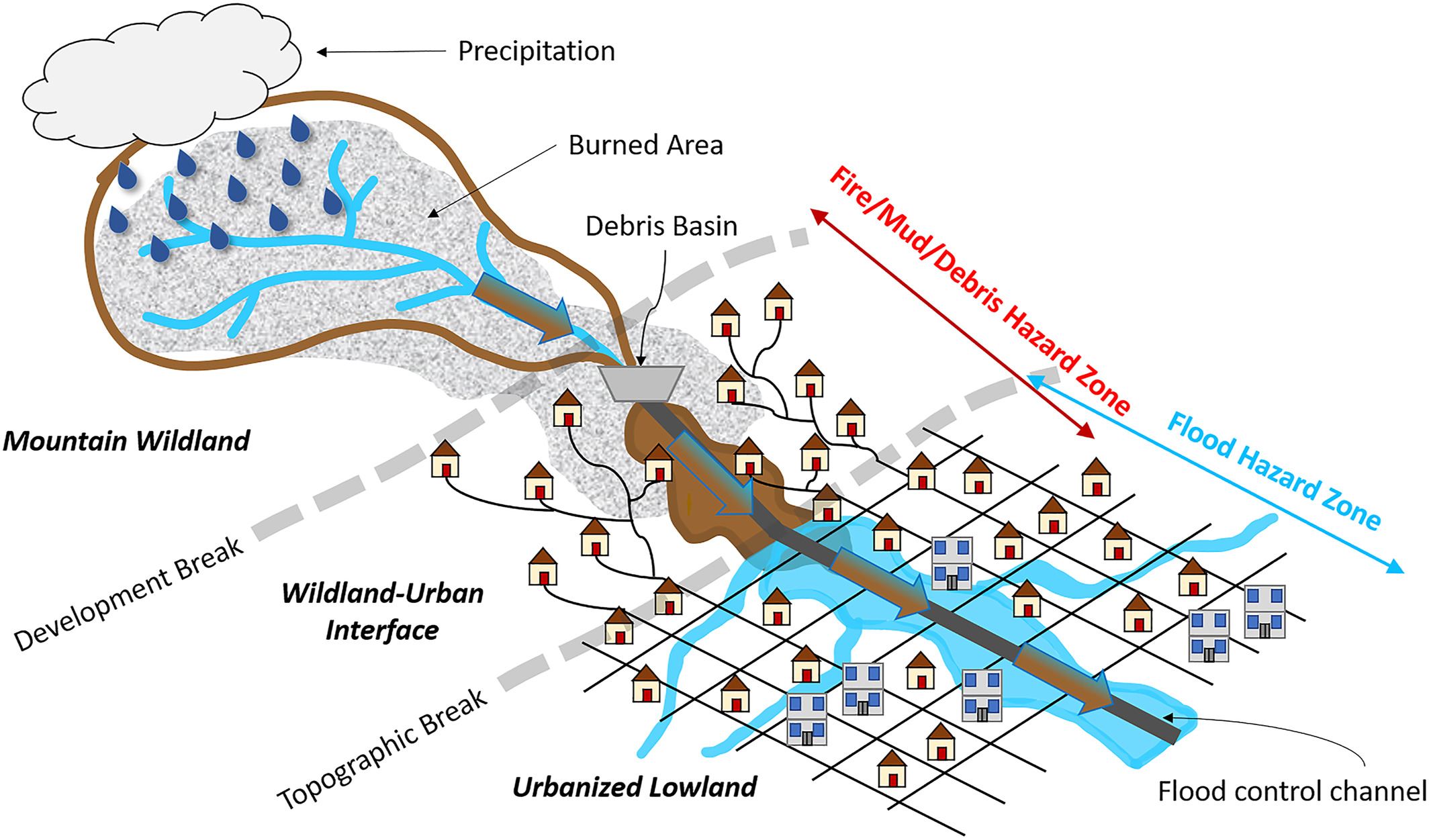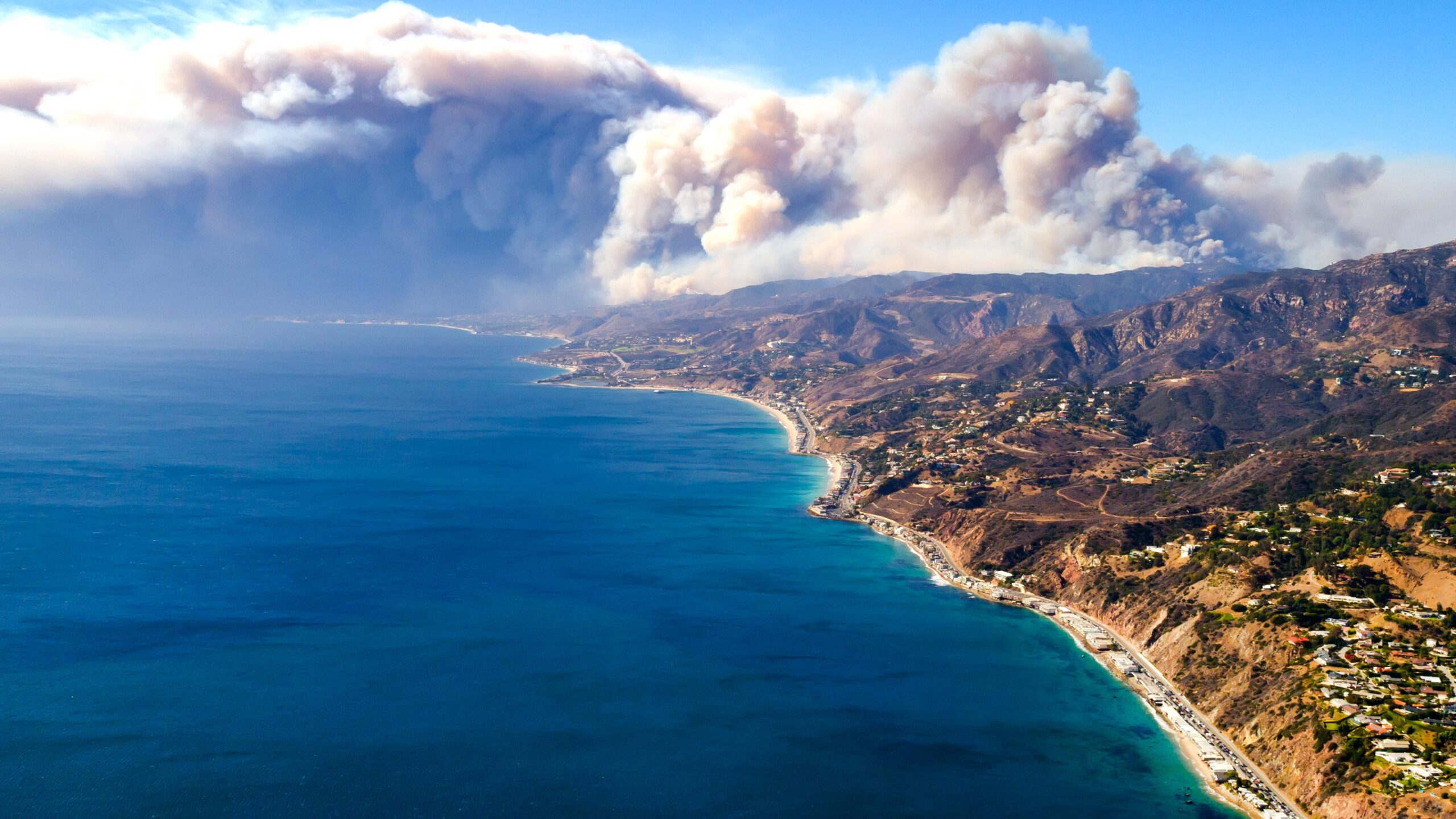
Across the western United States, wildfires are striking with greater frequency and intensity, increasing the risk of flooding and debris hazards following rainstorms. In response, NCCOS-funded researchers developed a model for Southern California that simulates present and future hazards to aid both short- and long-term risk management efforts.
Southern California is especially vulnerable to debris flow hazards because of its steep topography, frequent wildfires, expansive urban development, and intense precipitation. High-velocity flows with sediment, debris, and uncertain flow paths can cause devastating losses of life and property, such as occurred in 2018 when heavy rains carried mud and debris from burned areas of the Santa Ynez mountains through Montecito, California, taking the lives of 23 people and damaging over 400 homes.
The new model captures the interconnected influences of wildfires, rainstorms, and the subsequent reduced capacity of flood protection channels due to sedimentation. Simulations show that present-day hazards are up to six times greater based on the interaction of these processes compared to flood hazards in the absence of fires. Based on future increases in wildfire frequency, future flood hazards could be up to 11 times greater.
Simulations also show that hazards can be reduced with more intensive debris removal, excavation of flood protection channels, and maintenance of related infrastructure. Flood control agencies can use these model outputs to evaluate the cost-effectiveness of different management approaches under various climate change scenarios and multidecadal planning timescales.