
NOAA and its partners have published guidelines for using aerial drones to map the nearshore coastal seafloor.
Several organizations need imagery and elevation and depth data to effectively manage our nation’s coastlines. However, many nearshore areas are expensive, challenging, and even dangerous to map with conventional technologies, resulting in information gaps along the coastline.
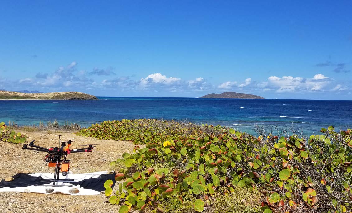
Small Unmanned Aircraft Systems (sUAS)—also known as drones—outfitted with cameras and coupled with advanced photogrammetry techniques, such as Structure from Motion (SfM), can provide a portable, efficient, and cost-effective method to fill some of these nearshore data gaps. The new report provides the results and analyses from over 100 sUAS bathymetric mapping flights, evaluating the influence of airframes, sensors, environmental conditions, and processing procedures.
The publication, Guidelines for Bathymetric Mapping and Orthoimage Generation Using sUAS and SfM, provides the coastal mapping community with guidelines and best practices for implementing the sUAS-SfM approach, and describes the operational and environmental limitations of sUAS and SfM for mapping in more remote locations and under more challenging environmental conditions. The recommendations are intended to encourage and aid the coastal mapping community in implementation and further advancement of the sUAS-SfM technique, and provide an alternative to traditional, more expensive nearshore collection techniques.
The research was funded by NOAA’s Unmanned Aircraft Systems (UAS) Program. The study was made possible by the support of many partners, including: NOAA’s National Centers for Coastal Ocean Science, Oregon State University, Wayne Wright Consulting, NOAA’s Office of Coast Survey, Buck Island Reef National Monument, NOAA’s ONMS Channel Islands National Marine Sanctuary, Channel Islands National Park, University of California, Santa Barbara and The Nature Conservancy.
For more information, visit the project webpage.