In partnership with the Woods Hole Oceanographic Institution (WHOI), the National Centers for Coastal Ocean Science (NCCOS) scientists completed the annual Gulf of Maine cyst sampling cruise aboard NOAA Ship Pisces (October 12-21, 2023). The research cruise is conducted annually to measure Alexandrium catenella cyst abundance in seafloor sediment samples. These data are critical for the development of the 2024 Gulf of Maine harmful algal bloom (HAB) forecast. Cyst distribution data are combined with oceanographic data from the U.S. Integrated Ocean Observing System Program and meteorological data from the National Weather Service to forecast severity of the spring Alexandrium bloom.
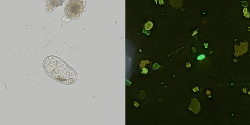
Alexandrium is a dinoflagellate species that survives the cold winter months by forming dormant seed-like cysts that accumulate in the region’s ocean sediments each fall. When water temperatures warm in the spring, the cysts germinate into flagellated adults that repopulate the water column and are transported to new areas by ocean currents. Blooms of Alexandrium can produce potent neurotoxins that can accumulate in marine shellfish. Consumption of contaminated shellfish with these toxins can cause a serious illness called paralytic shellfish poisoning (PSP) which can be potentially fatal. PSP poses a serious risk to commercial and non-commercial shellfish harvesting and aquaculture in the Gulf of Maine region, so the forecast products are provided to the States of Massachusetts, New Hampshire and Maine as well as an array of other regional stakeholders to help guide PSP monitoring and mitigation efforts.
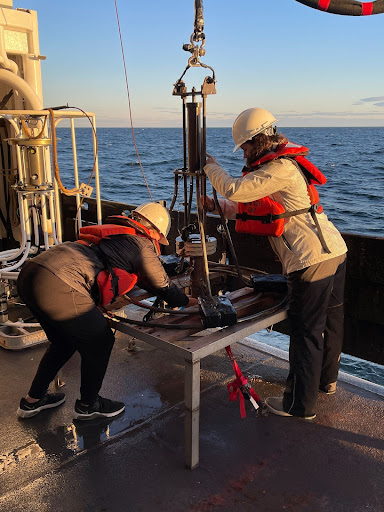
The scientists collected sediment samples and conductivity, temperature, and depth (CTD) data along an array of 57 stations between Cape Cod and the U.S.–Canadian border, the most stations from which scientists have been able to collect in almost ten years!
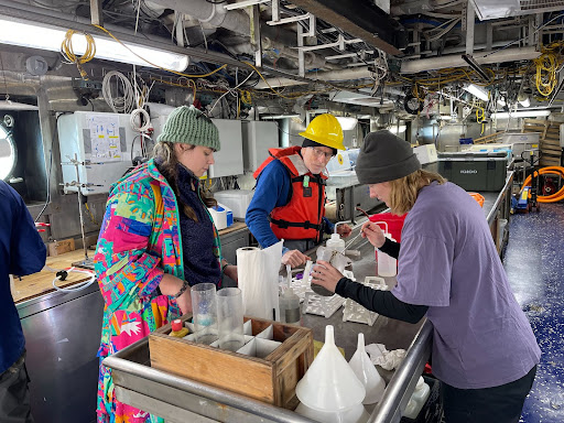
Once a core was collected from the bottom to the Gulf, the team extracted the top two layers of sediment and processed the samples to collect the cysts. The cysts collected in each sample will be counted under a microscope at the NCCOS Beaufort Laboratory in Beaufort, North Carolina. These data will produce a map of the distribution and abundance of cysts across the Gulf of Maine. This map will be combined with the physical parameters collected via CTD casts at each station and in-season meteorological data, like temperature, wind speed and wind direction, to produce the 2024 Gulf of Maine red tide forecast.
In addition to the seasonal forecast, weekly forecasts will be produced and available online throughout the spring and summer months.