Effects of Sea Level Rise
Event Response Program

This is a North Carolina Beach with protective dune showing heavy grass growth. (Dave Kidwell, NOAA)
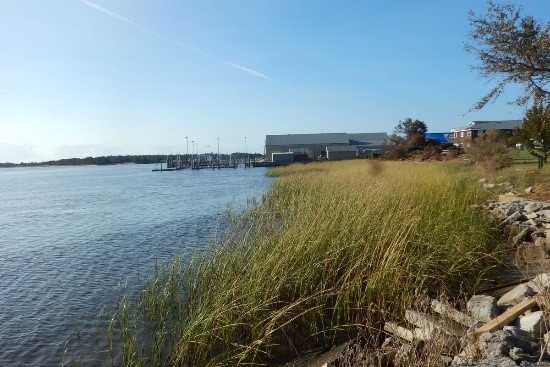
The living shoreline of cordgrass and oyster reef was built by NOAA to protect Pivers Island in Beaufort, North Carolina. (NOAA)

Oct. 14, 2016 – The onshore pounding of waves and storm surge from Hurricane Matthew washed away parts of the protective dunes at Jacksonville Beach, Florida. (NOAA)

Heavy equipment moves sediment around restored areas of a barrier island. Large scale projects offer potential solutions, however we still need to understand how they perform during storm events. (NOAA)
Decision makers are often unsure of using natural and nature-based infrastructure (NI) in lieu of traditional engineering practices due to the lack of information on how these features will perform during extreme weather events. The Effects of Sea Level Rise (ESLR) Event Response Program provides immediate assistance to individuals to gather data prior, during, and/or immediately after events that are difficult to plan for within the scope of a scientific study. These findings will potentially help federal, state, and local officials manage events and make sound decisions leading to safer coastal communities and healthier coastal environments. Modest funding (approximately $5,000 to $25,000 per project) is available to help offset costs of immediate mobilization of response and/or assessment efforts. Specific project activities of interest include pre- and post-event monitoring and modeling activities. These efforts must inform at least two of the following:
- Assessments of long-term ecosystem vulnerability,
- Habitat restoration or NI implementation planning,
- The ability of coastal ecosystems or NI to reduce and/or mitigate coastal inundation impacts on ecosystems, natural resources, or communities.
Prioritized events include but are not limited to:
- Weather-related events, such as nor’easters, tropical storms, nuisance flooding, abnormal wave conditions, or prolonged rain events;
- Anthropogenic associated events, including episodic events (e.g., flood driven opening of a water diversion) and singular events (e.g., unplanned levee breach). Anthropogenic activities with an extended planning cycle will not be considered.
Contact NCCOS ESLR Event Response team for more information or to inquire about support: nccos.eslr.event.response@noaa.gov
Rebecca Atkins, Competitive Research Program
Past Projects
- After the Storm: Mapping Changes in Bass Harbor Marsh (U.S. National Park Service)
- Researchers Successfully Test Wave-Rider Buoy to Track Storm Intensity
- Evaluation of Winter Storm Impacts in New Bedford, Massachusetts
- How Does Surface Salinity Impact the Root Zone in a Wetland?
- Post–Hurricane Dorian Data Collection to Improve Understanding of Beach, Dune Recovery Following Storms
- Evaluating the Resilience of North Carolina Natural and Living Shorelines following Hurricane Dorian
- Evaluating Wave Impact Reduction and Shoreline Protection Provided by “Oyster Reef Living Shoreline Projects” During Storm Events