This initiative joins community organizations, local governments, and educational institutions together to develop the knowledge, tools, and strategies that make communities along the Georgia coast more resilient. This project is made possible from Congressionally Directed Spending.
Why We Care
Increasingly frequent floods along the Georgia coast have exposed the acute vulnerabilities of residents to the growing threats of sea level rise (SLR), storm surge, and extreme precipitation under continued climate change. These threats often create severe localized flooding that impacts vulnerable communities. Communities can benefit from frameworks for transdisciplinary research that integrate knowledge and data streams across social, ecological, and environmental dimensions and advance the design and implementation of evidence-based solutions for coastal resilience.
What We Are Doing
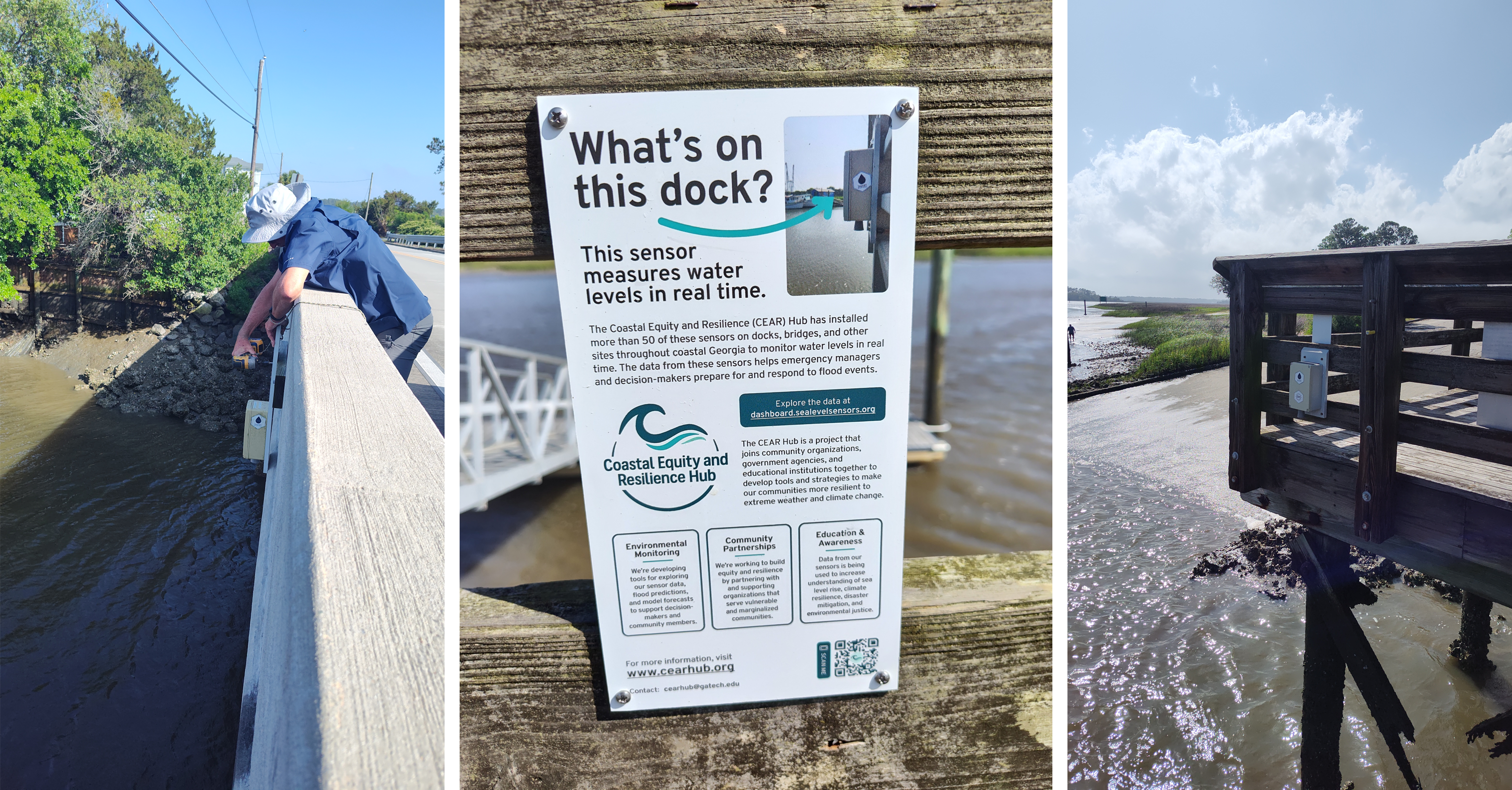
This project supports a network of academic, non-profit and community partners, promotes the resilience and sustainability of vulnerable Georgia coastal communities through integrative community-driven research, education, training, and outreach to produce evidence-based, scalable solutions to challenges related to flooding and sea level rise. The project team is working to build a future informed by data, guided by strategy, and empowered by knowledge through three primary objectives: 1) the establishment a stakeholder decision support system that combines a hyper-local water level observing sensor network and a coastal modeling system to provide real-time high-resolution and high-frequency flood data that coastal communities can use to plan for and respond to flood emergencies and design resilience and adaptation strategies for the long-term effects of projected flooding and sea-level rise; 2) the development and execute community engagement and planning strategies; 3) the development of enhanced K-12 programming and targeted workforce development.
This project is led by Russell Clark (PI) at Georgia Institute of Technology in collaboration with the City of Savannah, Chatham County Emergency Management Agency, The Harambee House, Pin Point Betterment Association, Coastal Georgia Indicators Coalition, Savannah-Chatham County schools, Tybee Marine Science Center, Savannah State University, and Brown University, and is supported by the NCCOS through a Congressional Directed Spending funding.