 An official website of the United States government.
  Official websites use .gov
A .gov website belongs to an official government organization in the United States.
Official websites use .gov
A .gov website belongs to an official government organization in the United States. Secure .gov websites use HTTPS
A lock or https:// means you’ve safely connected to the .gov website. Share sensitive information only on official, secure websites.
Secure .gov websites use HTTPS
A lock or https:// means you’ve safely connected to the .gov website. Share sensitive information only on official, secure websites.To better serve the nation's coastal managers and planners, NCCOS partnered with the Office of Coastal Management's Digital Coast team to develop the Coastal Aquaculture Planning Portal. The portal features over 20 tools that have specific applications for planning and siting of aquaculture operations and industries. For example, tools such as CanVis provide users with the ability to forecast seascape change due to aquaculture, a sea-level rise viewer allows the prediction of rising sea level on farming and management practices, and the habitat priority planner helps the user identify sensitive habitats that need to be avoided during aquaculture siting.
To learn more about NCCOS's coastal aquaculture siting and sustainability efforts, visit www.coastalscience.noaa.gov/science-areas/aquaculture/coastal-aquaculture-planning-portal-capp/.
For more information, contact James.Morris@noaa.gov.
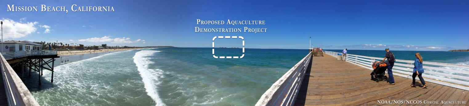
A CanVis simulation of an offshore aquaculture demonstration project reveals that the farm would have minimal impact on shoreline vistas. Tools such as CanVis can be used to support proper siting of aquaculture projects. Credit: NOAA.