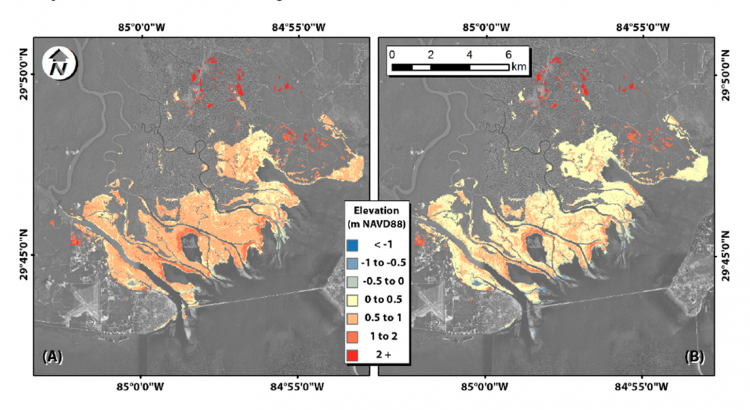
Coastal marsh elevation, a measurement used in models to predict impacts of sea level rise and periodic flooding from storm surge, is commonly determinedby remote sensing methods that have been found to overestimate marsh platform height. In order to address this inaccuracy, known as a ‘saturation problem’ caused by dense vegetation, NOAA’s National Centers of Coastal Ocean Science and Office of Coastal Management worked with the University of Central Florida to quantify the error associated with LIDAR-derived elevation and develop a mechanism for correcting the issue.
Scientists used a combination of field sampling and remote sensing to develop linear regression models relating the aboveground biomass density of salt marsh vegetation to variables derived from the remotely sensed LIDAR data in the panhandle of northwestern Florida at the Apalachicola National Estuarine Research Reserve.The topographic elevations were checked with benchmarks set by theNOAA National Geodetic Survey. Remote sensing data was provided, in part, by theNOAA Office of Coastal Management.
Researchers found that combining passive satellite optical imagery (e.g., Landsat) and data from active remote sensing sources (e.g., SAR and/or LIDAR) explains more variation in vegetation height and density than would either data source alone. These adjusted estimates can decrease the error associated with LIDAR digital elevation models by up to 49%.
Use of the adjusted digital elevation models will increase the accuracy of decision tools used by coastal regions for future land planning or flood preparation. Research findings were published in the scientific journal Remote Sensing .This research is part of the NCCOS sponsored Ecological Effects of Sea Level Rise Program.
For more information, contact David.Kidwell@noaa.gov .