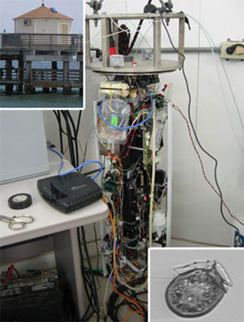
In mid-January, 2016, NCCOS funded investigators from Texas A&M University and the Woods Hole Oceanographic Institution convened a group of scientists and managers to produce a first-ever consensus vision for a network of real-time, continuous plankton imaging sensors or Imaging FlowCytobots (IFCB) in the Gulf of Mexico.

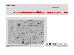
The envisioned network will expand a harmful algal bloom (HAB) alert system that uses classified, continuous plankton image data telemetered from a single, pier-deployed IFCB in Port Aransas operated by Texas A&M University (TAMU); graphical user interface for imagery data (a.k.a. IFCB Dashboard) developed by WHOI ; and data dissemination by TAMU via the Gulf of Mexico Coastal Ocean Observing System (GCOOS). Currently Texas agencies utilize IFCB-based HAB alerts to trigger more intensive bay monitoring that ensures shellfish are safe to eat and to determine the cause of large-scale fish kills. Fully implemented, an IFCB network could expand HAB early warning to other parts of the Texas coast and to other Gulf of Mexico states. Further, the resulting expanded access to continuous plankton monitoring data can enable development of adaptive solutions to manage anticipated future impacts on coastal resources from rising temperatures, more frequent tropical storms, expanded aquaculture operations, and potential for introduction of invasive species via ballast water discharge.

Perspectives of scientists and managers from the Texas Parks and Wildlife Department, the Texas Department of State Health Services, NOAA NCCOS, and the Gulf of Mexico Coastal Ocean Observing System helped ensure the relevance of envisioned network products to existing monitoring and forecasting programs and the scalability of the network to meet anticipated regional demand.
This vision and development of the network is supported by NCCOS project ‘ Expanding Harmful Algal Bloom Mitigation in the Gulf of Mexico with Operational Support and Training for the Imaging FlowCytobot Network.’ The project will also deploy another two IFCBs on the Texas coast, guide future production of more robust instruments for fixed deployments, and improve automated image classification of HAB taxa. The NCCOS project is advancing the development of HAB detection needs identified via the NOAA Ecological Forecasting Roadmap.
For more information, contact Marc.Suddleson@noaa.gov.
