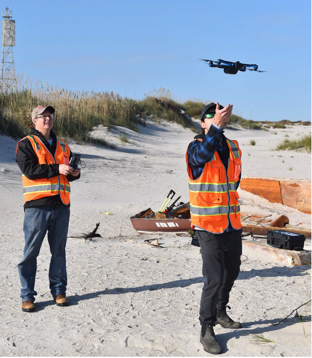
A new study from NCCOS, NOAA’s Office of Response and Restoration, and their partners shows that Uncrewed Aircraft Systems, or drones, equipped with polarimetric cameras could be used to detect and identify debris that washes up on beaches.
Marine debris, also known as marine litter, is a global problem that threatens the environment, navigation safety, coastal economies, and, potentially, human health. Detecting and identifying debris quickly and accurately is key to cleanup and response actions that can prevent these impacts.
On-the-ground beach debris monitoring requires time and labor, which limits its scalability. Drones can survey areas more rapidly, access hard-to-reach terrain, and provide greater spatial coverage than visual assessment methods on foot.
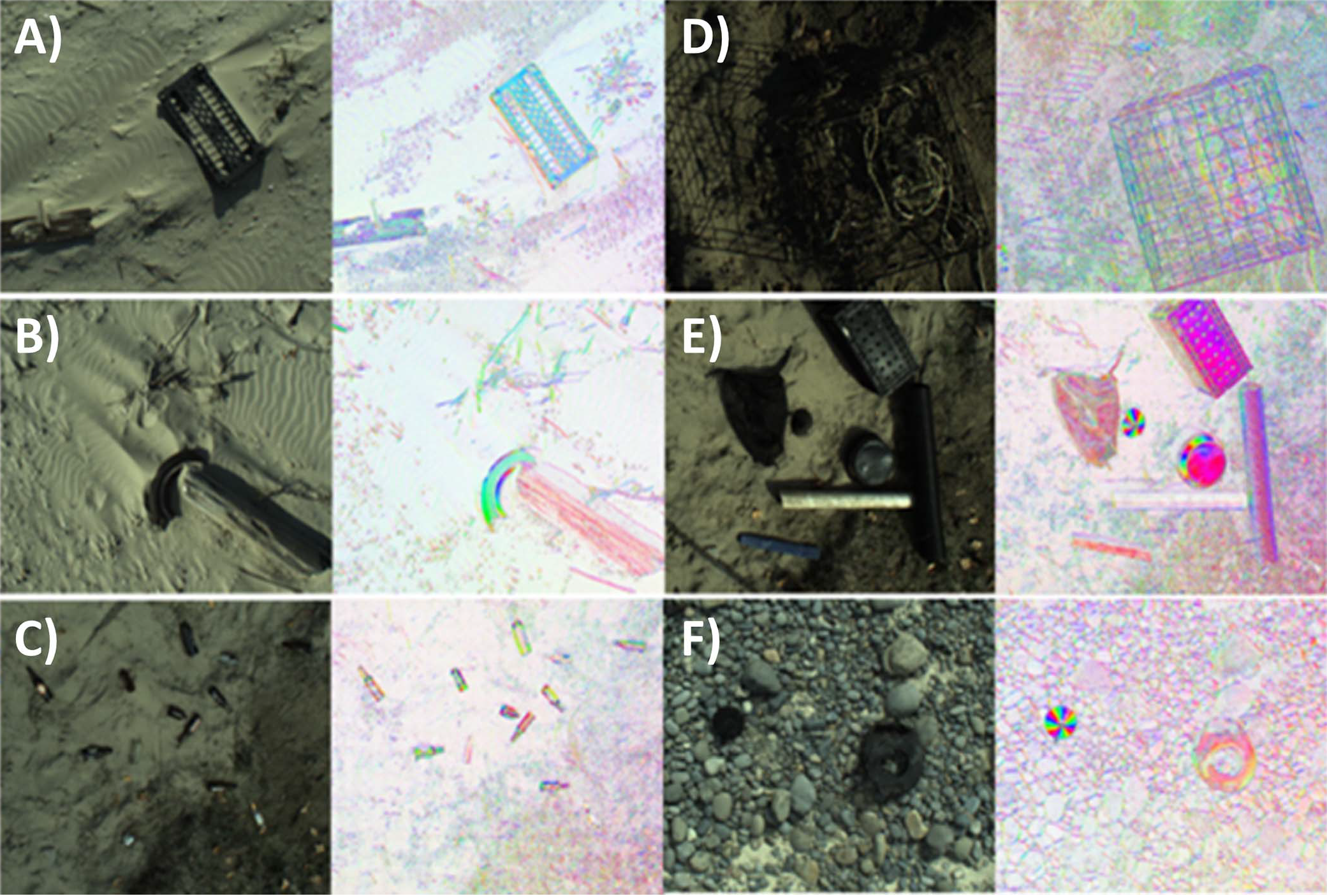
To date, drones for beach debris detection have used only conventional cameras that have three spectral bands (red, green, and blue, abbreviated RGB). However, RGB imagery has limitations for object detection. For example, RGB cameras have trouble “seeing” objects that don’t have enough contrast with the background land.
Polarized light reflected from human-made objects, on the other hand, often differs from natural objects, such as vegetation, soil, and rocks. Polarimetric bands also visually enhance object characteristics such as edge detail, surface texture, and dimensionality.
The study, based on field testing at Oregon and Texas beaches, is the first to examine and provide evidence that polarimetric imagery, when combined with RGB imagery, can improve detection of beach-stranded debris at least an inch long. The findings suggest that a polarimetric camera on a drone, paired with a machine learning system, could improve debris detection from the air.
As the commercial market for polarimetric imaging cameras continues to grow and sensors become more affordable and sophisticated, the researchers anticipate that polarimetric imagery will become increasingly useful for beach debris detection and mapping programs.
The project is a collaboration among NCCOS, NOAA’s Office of Response and Restoration, Oregon State University, ORBTL.AI, and Genwest Systems, Inc., and supports the National Coastal Monitoring Act and the Coastal Zone Management Act.
Credit: Oregon State University.