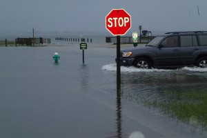
A NCCOS project to understand and predict changes in North Carolina coastal marshes, and their capacity to protect shorelines from the combined impacts of sea-level rise, tides, and storm surge partnered with the NOAA North Carolina Sentinel Site Cooperative. Project leader, Dr. Christine Voss (University of North Carolina Institute of Marine Sciences), combines research results and outreach with the North Carolina King Tides Project, documenting water levels through photography. While the term ‘king tide’ is not a scientific term, it is used to describe the natural and predictable highest high tide events of the year, when there is alignment of the gravitational pull between sun and moon. Dr. Voss invites North Carolinians to join the North Carolina King Tides Project to learn more about king tides and to share their photos of water levels.
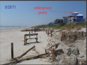
Dr. Peter Ruggiero (Oregon State University) leads another NCCOS project, also partnering with the North Carolina Sentinel Site Cooperative, to model and assess the impacts of sea level rise on North Carolina natural and managed beaches and dunes. This project enlists a local high school student and the NOAA National Weather Service local forecast office to obtain meteorological and tidal data for the project model.

This article was adapted from the NOAA North Carolina Sentinel Site Cooperative Sentinel Site Quarterly newsletter (Vol. 4, Issue 1, Winter 2016).
For more information, contact David.Kidwell@noaa.gov.
