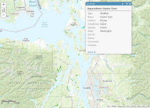
NOAA’s Office for Coastal Management and National Centers for Coastal Ocean Science have produced the first edition of the national coastal ocean aquaculture geospatial data layer. This project compiles current aquaculture data from 15 coastal states, standardizing aquaculture data into three categories (shellfish lease, finfish lease, and other [crustaceans, algae]). The layer shows the approximatelocation and size of aquaculture lease areas in the U.S. coastal zone and is availableon MarineCadastre.gov , an integrated marine information system that provides data, tools, and technical support for ocean and Great Lakes planning.

This new tool provides the first national spatial look at aquaculture around the U.S. including the type of aquaculture and the footprint in the coastal zone. It will be invaluable for national coastal managers and in future marine spatial planning projects. To work with the new layer, click this link and take a tour of coastal aquaculture around the nation. Of immediate interest are shellfish aquaculture hot spots in Willapa Bay, WA, Chesapeake Bay, VA, and Long Island Sound. Finfish culture can be observed in Puget Sound and coastal Maine.
To learn more about NCCOS’s Coastal Aquaculture Siting and Sustainability program and upcoming products visit our webpage .
For more information, contact James Morris.
