Every summer, the largest hypoxic zone in the U.S. forms in the northern Gulf of Mexico, resulting in widespread ecosystem and economic impacts. Determining, and then mitigating the size of this annual “dead zone” is a major goal of the Mississippi River/Gulf of Mexico Watershed Nutrient Task Force, also known as the Hypoxia Task Force (HTF). The HTF currently relies on a single week-long cruise to determine “dead zone” size for a given year and obtaining an accurate and consistent measurement is a challenge due to physical ocean conditions (i.e., waves, upwelling, downwelling) and unanticipated weather related events. These factors can impact formation and persistence of the “dead zone” and result in a measurement that does not reflect the actual average severity of hypoxia over a given summer.
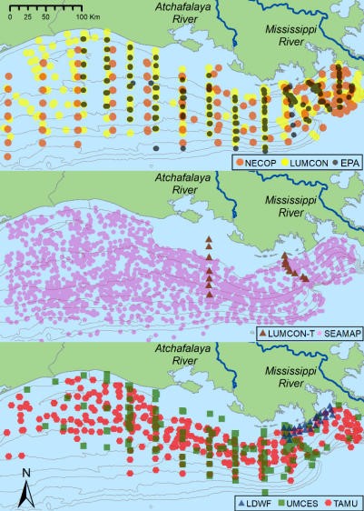
NCCOS-funded scientists recently published an innovative modeling approach that uses data collected by multiple research organizations to better characterize the size of the hypoxic zone. The technique substantially reduces uncertainty in hypoxic area estimates and provides new insights into the variability of hypoxia over the summer. Characterization of these changes over the course of a season are particularity important for management considerations as the new technique offers insights into how to account for limitations in current sampling designs and how to develop more comprehensive monitoring programs in the future.
Given the importance of hypoxic area estimates, the researchers expect the study results to refine the understanding of hypoxia drivers and ecological consequences, and to improve hypoxia forecast accuracy. The mid-summer cruise remains a suitable metric for assessing progress in reducing the hypoxic zone because it is a five-year average, and is not based on a single year. However, this new technique offers other ways to evaluate the annual size based on the duration of time the zone is present and the average zone size through time, which will be relevant to better understanding and quantifying ecosystem impacts.
This research is a product of the NCCOS Gulf of Mexico Ecosystems and Hypoxia Assessment Program (NGOMEX) project “Synthesis and Integrated Modeling of Long-term Data Sets to Support Fisheries and Hypoxia Management in the Northern Gulf of Mexico” led by Dr. Daniel Obenour of North Carolina State University and Dr. Kevin Craig of NOAA’s Southeast Fisheries Science Center.
Citation: Matli, V. Rohith Reddy, Shiqi Fang, Joseph Guinness, Nancy N. Rabalais, J. Kevin Craig, and Daniel R. Obenour. 2018. Space-Time Geostatistical Assessment of Hypoxia in the Northern Gulf of Mexico. Environmental Science & Technology 52 (21): 12484–12493. doi: 10.1021/acs.est.8b03474
For more information, contact David.Hilmer@noaa.gov.