NCCOS and partners are using large-area imaging (LAI) to monitor shallow water coral reefs and restoration. Now, they’ve published a guidance document outlining standard operating procedures and concepts of photogrammetry (the science of making measurements from photographs), so members of the coral reef research and restoration community can apply these techniques as well.
The guide is organized into two main sections. The first section fosters the understanding needed to conceptualize, design, and implement the LAI approach. The second explores eight case studies summarizing successful applications of this tech by experts in the field.
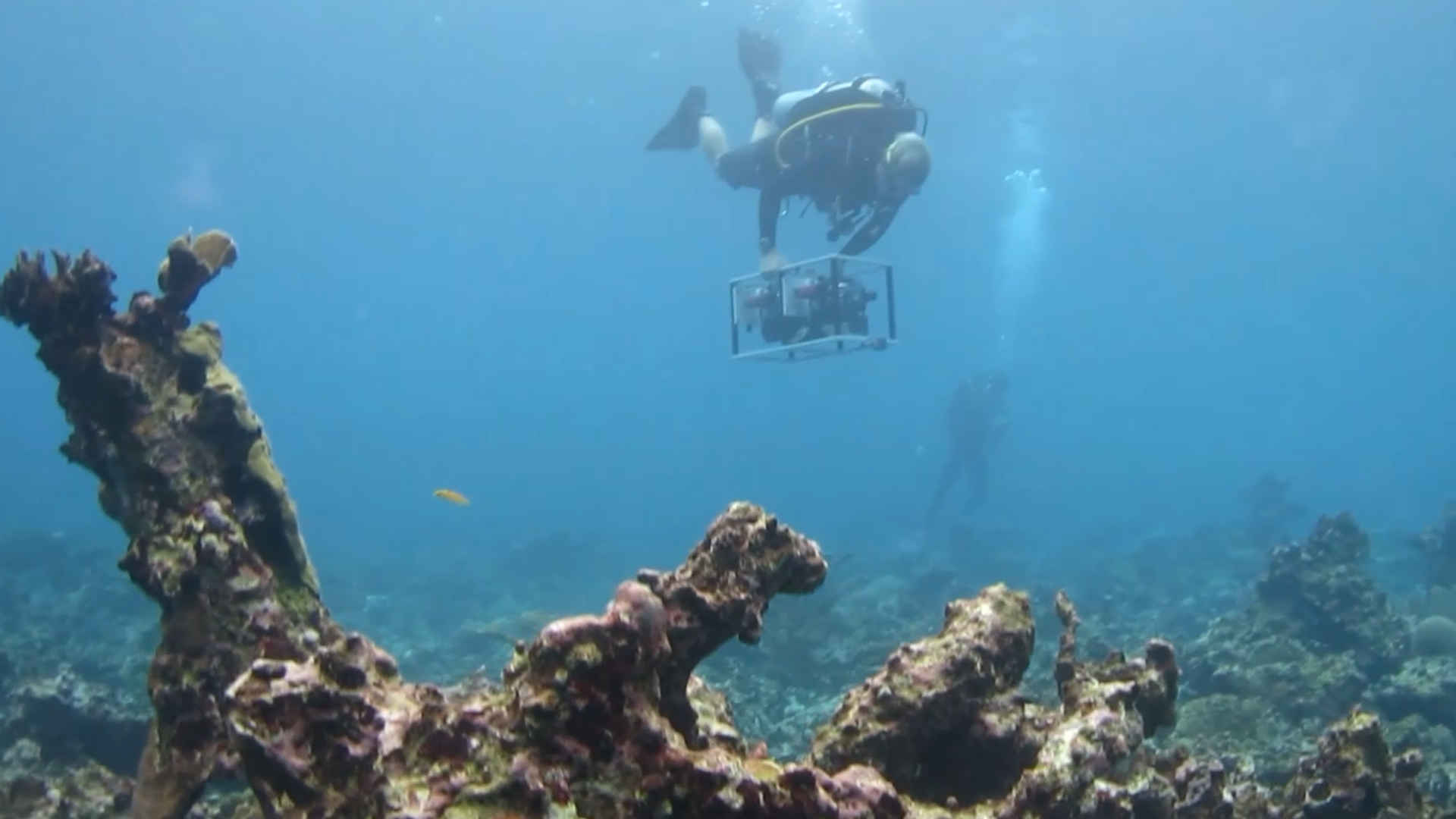
LAI is a photogrammetric approach which combines thousands of individual, overlapping images together using a Structure-from-Motion (SfM) software to generate photorealistic 3D representations of topographic surfaces, like the seafloor. This ability to navigate and interact with 3D models in a virtual reality environment promises users entirely new ways of observing and studying coral reefs.
For coral reef restoration and environmental monitoring, scientists often require time series or high resolution data that are difficult to extract from single photographs. LAI technology can be used to create visually detailed and precise reconstructions of the surveyed reef area, enabling the extraction of highly accurate data at nearly any desired spatial scale.
By stitching single images together to produce maps of coral reef habitats and 3D models of reef structure, users can better calculate key metrics for assessing reef health. LAI also provides a permanent digital snapshot of the habitat as it existed on the day it was photographed, which can be used as a baseline to track changes in the reef overtime.
The ultimate goal of this guide is to make the LAI process more accessible to a broad group of users in the coral restoration community, who can adapt the technology to support a wide range of coral monitoring, conservation, or restoration projects.
NCCOS Adapts LAI to Support Mission: Iconic Reefs
NCCOS is applying LAI technology to evaluate coral restoration efforts in support of Mission: Iconic Reefs, a large-scale restoration project currently underway at seven reefs along the Florida Keys reef tract. Image collection, 3D model processing, and data collection are all tailored to support the specific monitoring and restoration objectives of the project.
In collaboration with the Florida Keys National Marine Sanctuary, our researchers use a number of approaches to collect imagery for the generation of LAI, including diver-based surveys, shallow-water autonomous underwater vehicle surveys, and surface-operated drop-camera approaches. Once images are collected and 3D models are generated, the scientists can extract highly specific taxonomic data, calculate metrics like percent cover or reef complexity, and calculate precise estimates of coral size and growth – all of which can be used to help evaluate restoration success. Learn more about the project.