Biogeographic and Ecological Assessments
Biogeographic assessments involve the compilation and integration of an array of data types for the purpose of better understanding current and changing conditions in coastal and estuarine areas. Integration of these data sets into common spatial frameworks allows for statistical modeling and the identification of linkages between different environmental factors. Such assessments inform decisions for a range of coastal management topics, such as ecosystem-based management of fisheries, coastal land planning, and ocean energy development. They tend to include physical, chemical, and biological data. Some assessments primarily leverage existing data, while others involve new monitoring and sampling efforts. Ecological assessments are more broad-based activities and range from defining the characteristics and status of ecosystem components that provide baseline conditions to detecting change in those conditions over time.
Choptank River Assessments
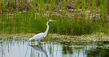
The Choptank River flows through rural lands along the Eastern Shore of Maryland, midway up the Chesapeake Bay. The river and its watershed serve as home to many economically and recreationally important species, and are the site of extensive oyster restoration efforts. In 2014, the Choptank and Little Choptank Rivers were designated as a Habitat Focus Area under NOAA’s Habitat Blueprint Program. NCCOS contributed to research in the Choptank in a number of meaningful ways, including both a retrospective ecological assessment of the entire system which summarized existing data, and an ecological assessment of current conditions in the Tred Avon River, a key tributary of the Choptank.
This work was followed by a pilot assessment exploring fish habitat in the Choptank River. For this study, NCCOS led a Chesapeake Bay fish habitat assessment team which developed a new two-dimensional grid-lattice structure for the entire bay and evaluated the utility of that structure in the Choptank River. Fifteen environmental variables were integrated into the framework to explore and demonstrate options for inclusion of different data types. The framework was exercised to explore its utility for assessing aspects of fish habitat.
A Pilot Assessment of Fish Habitat in Choptank River Tidal Waters
To help understand and manage these habitats in the Chesapeake Bay, we will develop a GIS-based analytical framework that might be used to assess habitat in tidal waters of the Choptank River.

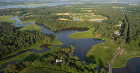
Choptank ecological assessment: digital atlas-baseline status report
NOAA designated the Choptank watershed as a Habitat Focus Area for the Habitat Blueprint Program. The HFA Implementation Plan includes programs for: oyster restoration, wetlands, living shorelines, fish passage, and more.
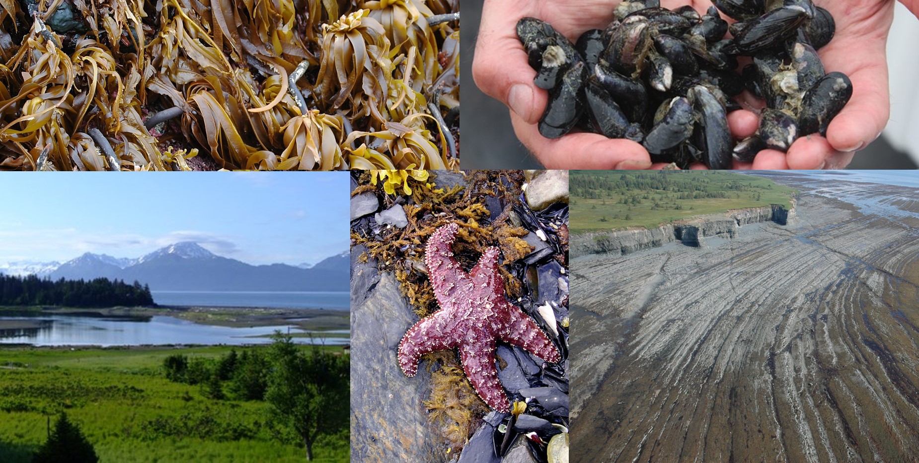
Kachemak Bay Ecological Assessment
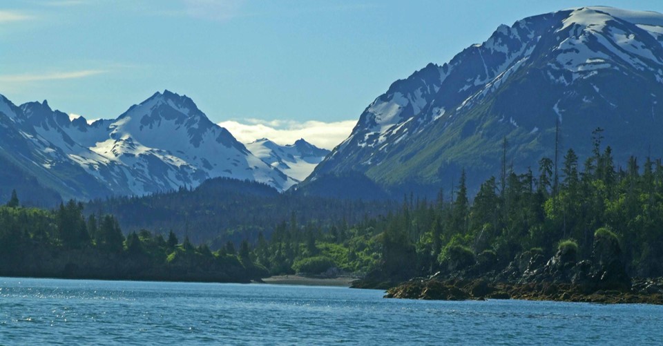
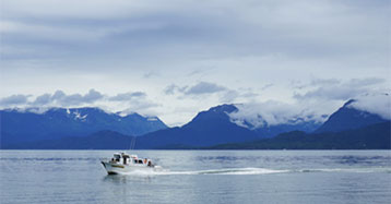
Kachemak Bay is a subarctic estuary in south/central Alaska that contains all of the estuarine and coastal habitats found in the Gulf of Alaska, including the rocky intertidal zone, kelp forests, seagrasses, mudflats, glacial rivers, and salt marshes. It is home to threatened and endangered marine species, and provides refuges and habitat for shellfish, fish, seabirds, and marine mammals. The bay supports recreational, subsistence, and commercial fishing; marine transportation; and tourism. In recent years, declines in shellfish and fish populations; increased fishery closures; threats from harmful algal blooms; oil and gas development; ocean acidification; invasive species; and pathogens have become worrisome.
Our ecological assessment of Kachemak Bay incorporates various data sets into a consistent framework, making it easier for stakeholders to understand the state of the bay and track trends or changes. The assessment helps inform resource and coastal managers of estuarine and coastal habitat issues affecting not only Kachemak Bay, but other coastal regions in Alaska, such as Cook Inlet and the Gulf of Alaska. Results and products from the Kachemak Bay ecological assessment will identify gaps in available information and help inform priority-setting for future NCCOS and partner research efforts.
Hawai‘i Assessment
The state of Hawai‘i is working to develop local renewable energy sources to reduce its dependence on fossil fuels. NCCOS conducted an assessment of the federal waters around the Main Hawaiian Islands (MHI) in order to provide critical information to BOEM for regulating renewable energy projects in these waters. We compiled existing, readily-available data sets and created maps describing the physical environment, benthic communities, fishes, turtles, whales, dolphins, seals, and seabirds around the MHI. Species or groups that were: more likely to interact with renewable energy infrastructure (e.g., wind turbines); were culturally significant; had state or federal protected status; or were economically valuable were given special consideration. Analyses were specifically designed for compatibility with BOEM’s regulatory framework of aliquots and lease blocks, and depended on the completeness and limitations associated with the existing datasets.