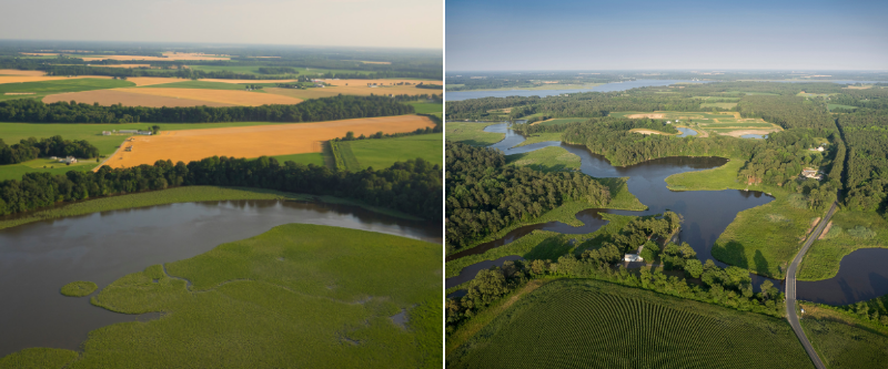
Fish and shellfish populations depend on healthy habitats. To help understand and manage these habitats in the Chesapeake Bay, we will develop a GIS-based analytical framework that might be used to assess habitat in tidal waters of the Choptank River. Experts will provide input on the design of the framework and the types of data that it should include. Recommendations for conducting fish habitat assessments in Chesapeake Bay tidal waters will then be developed.
Why We Care
Gaps remain in our understanding of how environmental factors and habitat availability impacts fish in Chesapeake Bay. In order to fill some of those gaps, NCCOS has engaged in assessments of fish habitats in the Bay. In this project, NCCOS will develop a geographic information based statistical framework that can be used to evaluate fish and shellfish habitat in tidal waters of the Choptank River, with potential application to all Chesapeake Bay tidal waters.
What We Are Doing
NCCOS PIs will develop a GIS-based analytical statistical framework capable of assessing fin-fish and shellfish habitat in tidal waters of the Choptank River. The design will consider the specific spatial characteristics of the Choptank environment while being applicable to all Chesapeake Bay tidal waters and mindful of the nontidal framework being used by collaborators at the USGS Leetown Science Center. The tidal framework will incorporate and represent a variety of different physical and biological datasets that may be important for assessing fish habitat.
The NCCOS team will hold workshops to seek expert opinion on which datasets might be included in the framework and how those datasets might be incorporated and analyzed to 1) determine the relative quality of habitat throughout the river and 2) attempt to determine drivers of fish occurrence in the river, such as impervious surfaces or seagrass distribution.
- Using a small set of variables, develop an analytical, statistical framework for a candidate tributary (Choptank River) – Completion April 2020
- Review the analytical and statistical framework with regional experts – Workshops held in October 2020
- Testing of analytical framework for select tributary(s) (Choptank River) to inform development of recommendations for extending framework – Completion December 2020
- Report of recommendations for extending the tidal analytical /statistical framework from candidate tributary (Choptank River) to Chesapeake Bay tidal areas distributed to the Chesapeake Bay Program Sustainable Fisheries Goal Implementation Team (Fish GIT), Fish Habitat Action Team, and other stakeholders – Completion January 2021
- In collaboration with USGS Leetown Science Center and NMFS/OHC/NCBO, identify options for joint NOAA-USGS pilot, encompassing non-tidal and tidal habitats and applying respective NOAA and USGS methods used in prior tidal and non-tidal habitat assessment work – Completion October 2021
Benefits of our Work
This project will develop a statistical approach and provide recommendations for understanding fish habitat utilization and connectivity for key species and improve understanding of habitat and water quality relationships. Project deliverables are intended to support management decisions in the selected tributary and assist the Chesapeake Bay Program in conducting fish habitat assessments for other tributaries of the Bay and across non-tidal and tidal waters.
This project directly supports the habitat outcome of the 2014 Chesapeake Bay Agreement and is part of the broader Chesapeake Bay Habitat Assessment effort. The work is integrated into the Chesapeake Bay Program 2020 -2021 Fish Habitat Logic and Action Plan with associated milestones and collaborations.
Furthermore, this project strengthens NCCOS research capabilities and elevates NCCOS’s role in addressing Chesapeake Bay Program needs. NCCOS employees have been key members of the multi-agency team working on the fish habitat assessments identified by the Agreement. Moreover, NCCOS has extensive experience with habitat mapping and geo-spatial analysis which will be crucial to achieving the project objectives.