We are evaluating how highly migratory and protected species, including cetaceans, fishes, pinnipeds, seabirds, and turtles, are using a network of state and federal marine protected areas (MPAs) in the Gulf of Maine and southern New England regions, and how this overlaps with areas of human use. Understanding the benefits of existing MPAs to species at risk will inform recommendations for potential new or expanded MPAs, and ensure their viability for future generations.
Why We Care
MPAs are one of the tools used to protect significant natural and cultural resources for the benefit of present and future generations. Highly migratory species (e.g., whales and sharks) are regular visitors to MPA habitats. An MPA may serve a variety of functions for these animals, including providing breeding and foraging habitat, as well as transiting corridors. It is not well understood whether benefits gained while within the MPAs have cascading effects that extend beyond their boundaries. Different species may carry benefits with them along their broader migrations, and species may bring resources to the MPAs from outside. To enable an effective network of MPAs, core habitats must be connected by ecological corridors that conserve biological diversity in systems that have been fragmented. Well-connected networks of MPAs can also help species and ecosystems adapt to climate change by protecting climate refugia or providing a “safe landing place” for species undergoing range shifts.
We are evaluating how highly migratory and protected species, including cetaceans, fishes, pinnipeds, seabirds, and turtles are using a network of state and federal MPAs and surrounding areas, and how their use intersects with human use in the same regions. Specifically, we are targeting the New England region including the Stellwagen Bank National Marine Sanctuary, the five MPAs surrounding the coast of Massachusetts, and the Northeast Canyons and Seamounts Marine National Monument, as well as nearby southern New England waters. These evaluations will be used to understand the benefits of existing MPAs to species at risk, as well as to inform recommendations for potential new or expanded MPAs, advancing the scientific understanding needed to protect coastal and ocean resources and ensure their viability for future generations.
What We Are Doing
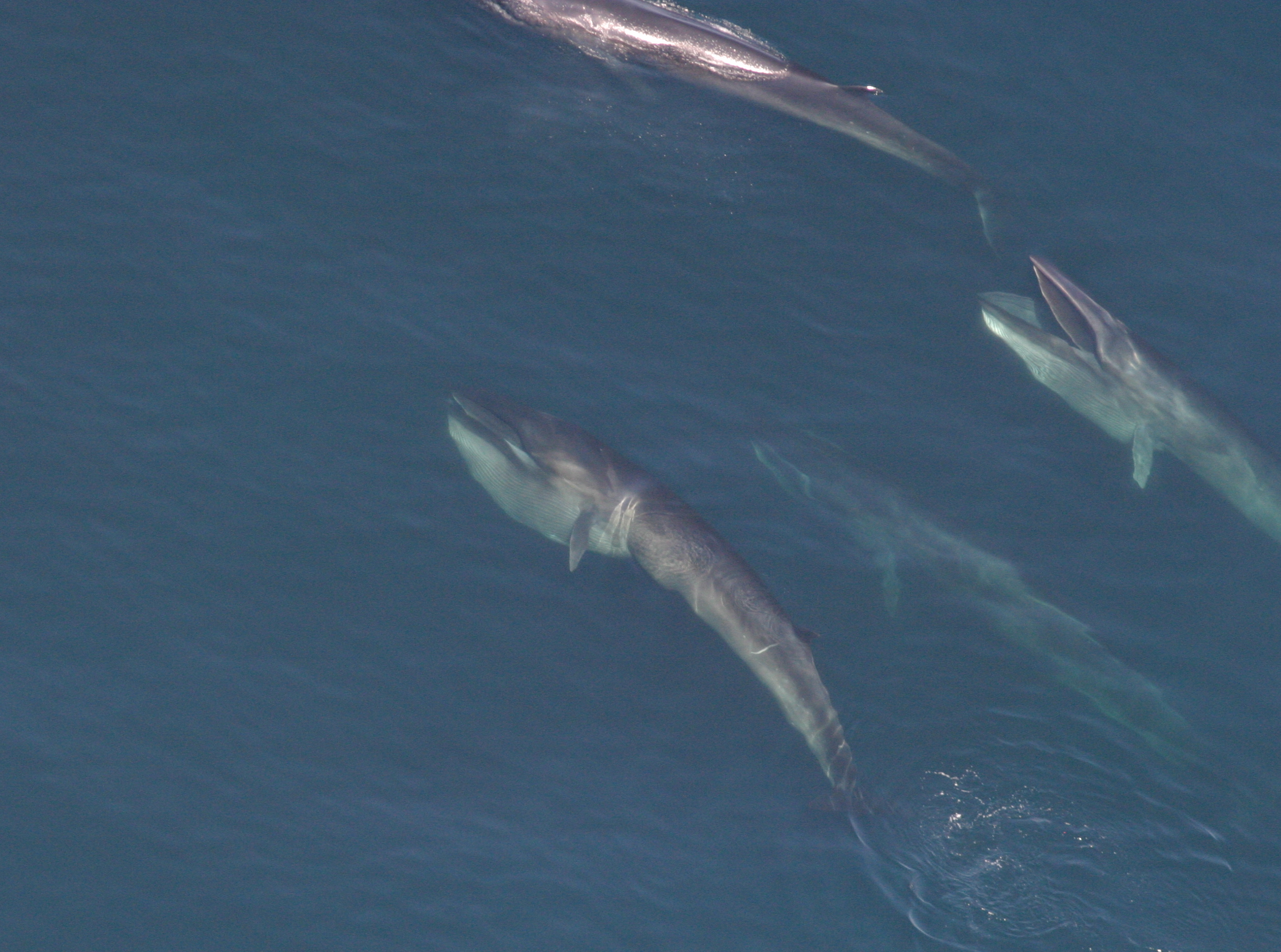
We are collecting information on priority species for which significant data gaps exist. These species include fin and sei whales (Balaenoptera physalus, B. borealis), gray and harbor seals (Halichoerus grypus, Phoca vitulina), leatherback (Dermochelys coriacea), Kemp’s ridley (Lepidochelys kempii), and green sea turtles (Chelonia mydas), great shearwaters (Ardenna gravis), sooty shearwaters (A. grisea), northern gannets (Morus bassanus), and a variety of fishes, such as striped bass (Morone saxatilis), white, sandbar, and sand tiger sharks (Carcharodon carcharias, C. plumbeus, C. taurus), and black sea bass (Centropristis striata). We may also collect opportunistic data on loggerhead sea turtles (Caretta caretta) and Atlantic white-sided dolphins (Lagenorhynchus acutus).
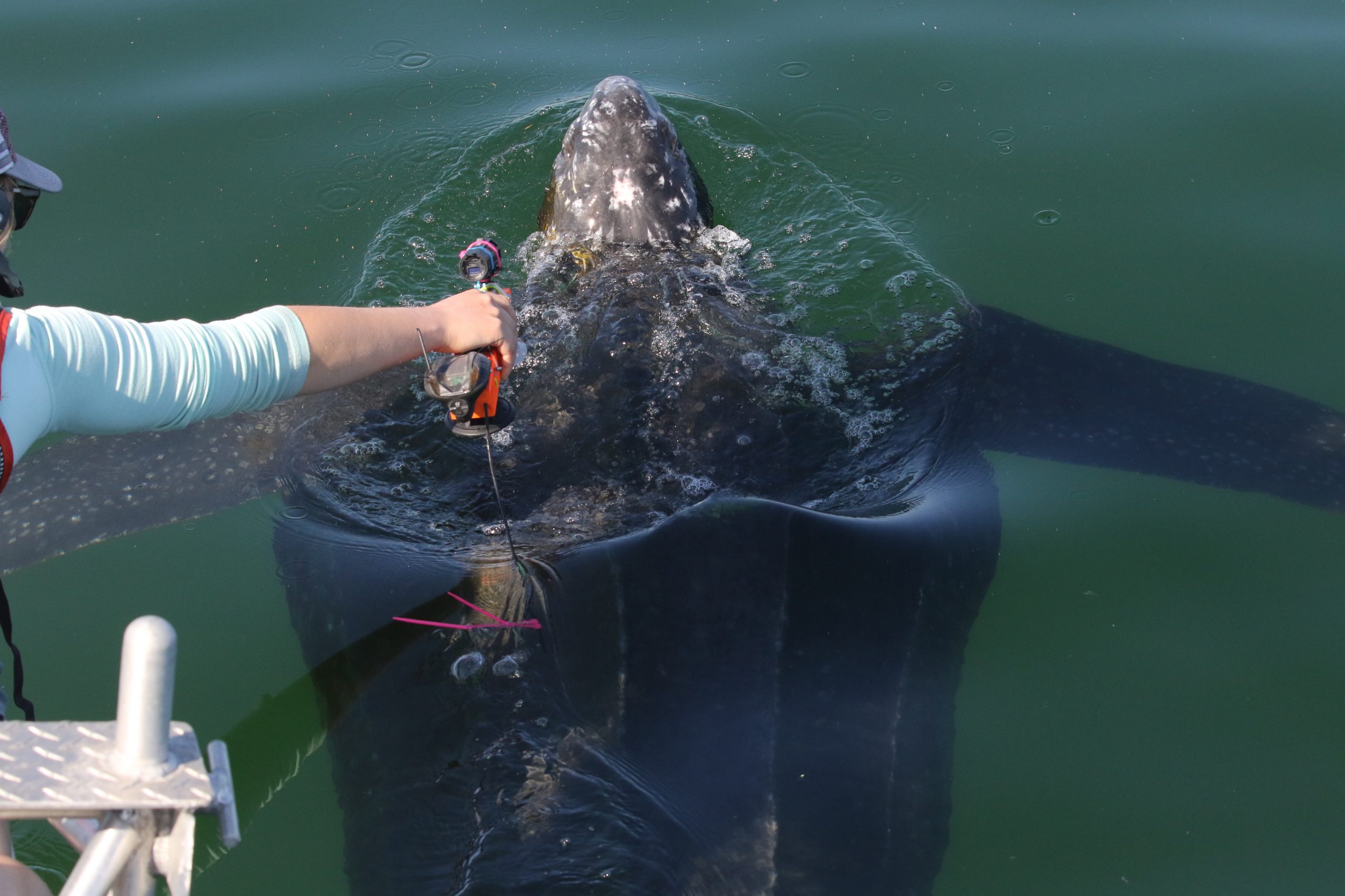
Using acoustic and satellite telemetry to track animal movements, stable isotope analyses to determine their food sources, and existing abundance/density data, we will assess the habitat requirements (i.e., home range, site fidelity, and habitat utilization) and foraging characteristics for focal species. Combined with other physical and biological data, we will strive to understand drivers of habitat preferences that may govern connectivity between species and regions across space and time.
To ensure that our project and its outputs are useful to managers, we will work closely with resource managers to translate our results. This study will provide managers with the information and tools to investigate whether the size, location, regulations, and zonings for a network of New England MPAs are sufficient to ensure and enhance the persistence of the highly migratory and protected species that use it.
This work is part of the Regional Ecosystem Research Program’s Federal Funding Opportunity focused on understanding species’ habitat usage and connectivity funded by NCCOS and conducted in collaboration with the Office of National Marine Sanctuaries and the National Marine Protected Areas Center. It is led by Danielle Cholewiak (NOAA Fisheries Northeast Fisheries Science Center) and a team of seven scientists at four different institutions (NOAA’s Northeast Fisheries Science Center and Stellwagen Bank National Marine Sanctuary, Massachusetts Division of Marine Fisheries, and Integrated Statistics).