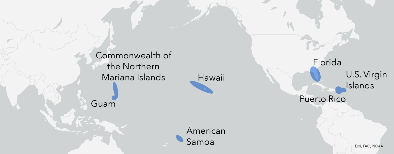
NCCOS scientists are working to conduct a data needs assessment for each of the seven U.S. coral reef management jurisdictions (Figure 1). The team has developed an interactive hub “Coral Reef Prioritization | A Roadmap for Future Mapping” to provide a publicly available, one-stop site for project information, timeline, data, web applications, and results. This site will be updated regularly with new information as each jurisdiction is completed.
Spatial information about the seafloor is critical for environmental decision making by coastal management organizations. This project will enable NOAA and partnering coral reef management agencies to understand overlapping data needs and identify priority locations that are in need of new benthic mapping data.
The work is funded by NOAA’s Coral Reef Conservation Program. Results from this project will provide local management agencies the necessary information for effective coral reef conservation and management.