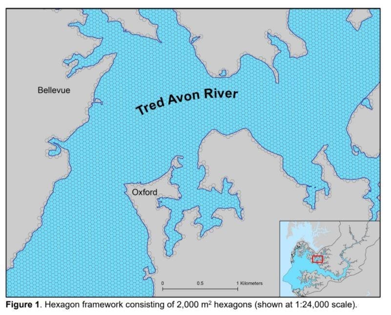
In response to declines in fish habitat, the 2014 Chesapeake Bay Agreement set an objective to “continually improve the effectiveness of fish habitat restoration and conservation efforts” (CBP, 2014). To address this objective a team of collaborators was established and a series of activities were initiated, including a Bay Program sponsored workshop in 2018 which prompted an inventory of available datasets and assessment efforts. These assessments were largely limited to national datasets or specific funding objectives, but do lend insights into how fish habitat assessments were conducted.
 The collaborative Chesapeake Bay fish habitat assessment team divided pilot analytical assessment efforts between tidal and nontidal waters. For nontidal waters, the National Hydrography Dataset framework was chosen for the assessment framework. For tidal waters, a new two dimensional grid-lattice structure was developed for the entire Bay and was evaluated for utility by using the Choptank River as a pilot. Fifteen variables were integrated into the framework to explore and demonstrate options for inclusion of different data types, such as linear versus polygon data, and for different data summarization methods, such as average over time or proximity to other metrics. The framework was exercised to explore its utility for assessing aspects of fish habitat.
Subject matter experts were consulted through two virtual meetings in October 2020 to provide feedback on the pilot framework’s structure, including: types of data to apply to the framework, methods to integrate various datasets into the framework, and types of analysis feasible to conduct using the framework. A robust set of read-ahead materials was developed and delivered to participants prior to the meetings. During the workshops, a large amount of feedback was offered and catalogued.
The resulting report, “Recommendations for Conducting Fish Habitat Assessments in Tidal Waters of the Chesapeake Bay“, identified nine key recommendations, including continued development of assessment methods with a focus on a headwaters-to- tributary pilot assessment, collaboration with data holders, addressing data gaps and incompatibilities, and fostering communication with likely assessment users to ensure the application addresses their needs.
This project strengthens NCCOS research capabilities and elevates NCCOS’s role in addressing Chesapeake Bay Program needs.
