A team of scientists from NOAA’s National Centers for Coastal Ocean Science (NCCOS) and partner organizations has set sail for a three-week (March 15 -April 3) expedition aboard theNOAA ShipNancy Foster to map and study the sea floor and fish distributions off the northeast and southern coasts of St. Croix, U.S. Virgin Islands. These high-priority areas were selected by jurisdictional partners due to their significance to commercially important fisheries and the need for updated nautical charts.
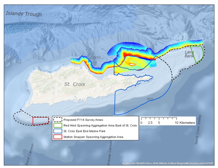
This is NCCOS’s 11th year of an ongoing scientific research program to map habitats in portions of the U.S. Virgin Islands and Puerto Rico in support of local resource managers. The data collected will also help support updating NOAA nautical charts for the region.
‘Our goal is to collect data that we will then use to create high-resolution maps of the sea floor and of fish distributions to help on-the-ground managers understand where key resources are located,’ Tim Battista, the mission lead and an oceanographer with NCCOS, explained. He continued, ‘Accurate sea floor and species maps are important tools for local managers and decision makers who must balance multiple uses of marine resources.’
Tech Focus
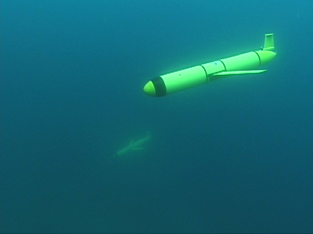
This year, researchers are partnering with the Naval Oceanographic Office to acquire data for oceanographic modeling purposes, while simultaneously exploring little known grouper and snapper spawning aggregations with an autonomous G2 Slocum Electronic Glider. The mission represents a new and much more cost effective way to study fish spawning aggregations. (Click here to learn more about NCCOS’s use of glider technology.)
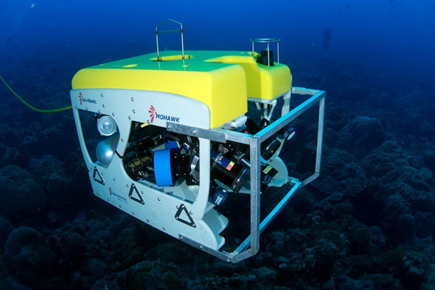
Scientists will also work with a new SubAtlantic Mohawk 18 remotely operated vehicle (ROV) owned and operated by the University of North Carolina -Wilmington’s Undersea Vehicles Program. Together with data collected by multibeam echosounders, drop cameras, and other technology, thishigh-performance fiber optic ROV system will be used to paint a clear picture of the sea floor.
Ocean Exploration and Science Fueled by Partnerships
Funding for this work is provided by the NOAACoral Reef Conservation Program. The G2 Slocum Electronic Glider is provided by the Naval Oceanographic Office. Partners include: the USVI Department of Planning and Natural Resources, the Caribbean Fishery Management Council, the University of the Virgin Islands, the USVI Coastal Zone Management Program, and the National Park Service.
Be sure to visit NCCOS News often for field updates and pictures posted by members of the science team.