Home > Explore News > NCCOS Tests Drones to Map Coastline and Nearshore Waters

NCCOS Tests Drones to Map Coastline and Nearshore Waters

Published on: 02/04/2019
Primary Contact(s): bryan.costa@noaa.gov

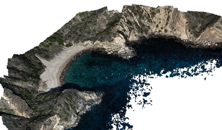
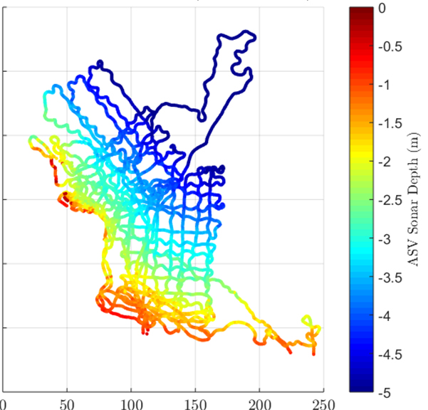
In December, NCCOS scientists and their partners used both airborne and water surface drones to map land elevations and water depths around Santa Cruz Island, the largest of the Channel Islands, off the coast of southern California. The depth soundings collected by the water surface drones will be used to validate the depths derived from the digital aerial photos taken by the airborne drones.

Following the team’s successful testing of several airborne drones in a tropical environment last spring, the researchers sought to identify the potential of drone technology in a more challenging, temperate environment, such as the Channel Islands. The team is using data from these missions to define the environmental and operational limitations of drones, and to better understand how these technologies complement and advance NOAA’s existing seafloor mapping capabilities. Drones may offer an inexpensive and accurate way to map coastal regions that are difficult to access, providing many organizations the photographs, elevation, and depth data needed to inform coastal management decisions.

Three dimensional model of Coches Harbor, Santa Cruz Island, CA, developed from digital aerial photographs collected by the small unmanned aircraft system (sUAS).

Three dimensional model of Coches Harbor, Santa Cruz Island, CA, developed from digital aerial photographs collected by small unmanned aircraft system (sUAS). Credit: NOAA.


The researchers collected thousands of water depth soundings using an autonomous surface vehicle (ASV). This information will be used to validate the depths derived from the sUAS photographs. These platforms, combined with Structure from Motion (SfM) software, are capable of producing centimeter-scale photo mosaics, elevation, and depth data for nearshore environments.

The researchers collected thousands of water depth soundings using an autonomous surface vehicle (ASV). This information will be used to validate the depths derived from the sUAS photographs. These platforms, combined with Structure from Motion (SfM) software, are capable of producing centimeter-scale photo mosaics, elevation, and depth data for nearshore environments. Credit: NOAA.

Explore Similar News

About NCCOS

NCCOS delivers ecosystem science solutions for stewardship of the nation’s ocean and coastal resources to sustain thriving coastal communities and economies.

Stay Connected

Sign up for our quarterly newsletter or view our archives.

NCCOS Multimedia

Visit our new NCCOS Multimedia Gallery. 

Follow us on Social

Listen to our Podcast

Check out our new podcast "Coastal Conversations"