Last month, NCCOS scientists and their partners tested the utility of drone technology to map the coastline and nearshore waters of St. Croix in the U.S. Virgin Islands. The team evaluated the quality of land elevation and water depth data acquired by three different drones under a variety of conditions.
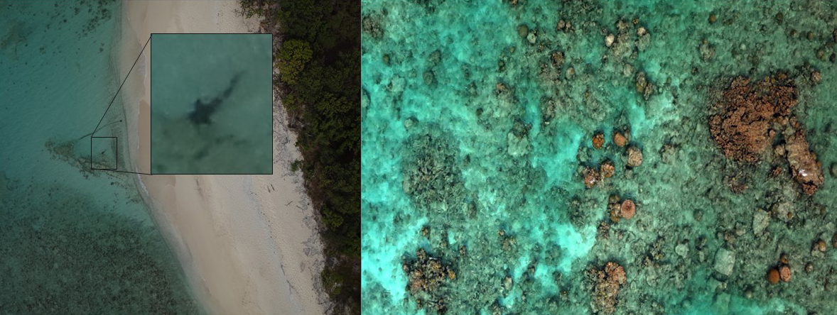
Several agencies, including NOAA, need land elevation and water depth data to inform management decisions about the coastal zone. However, many nearshore areas are difficult to access, or are remotely located, making them challenging and expensive to map with existing technologies. Photographs acquired by drones offer a potentially inexpensive and accurate method to fill this data gap at spatial resolutions that far exceed existing technologies. Though, more research is needed to identify optimal drone payloads and parameters, as well as post-processing workflows, before drone technology can be implemented more widely across NOAA.
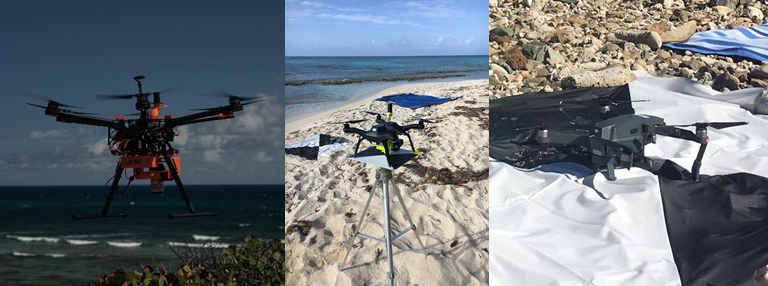
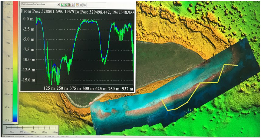
During the mission, the team mapped six geographic areas in the Buck Island Reef National Monument and the East End Marine Park, collecting over 48,000 digital aerial photos using the DJI S900, 3DR Solo, and DJI Mavic drones. The researchers also collected independent reference data sets to verify the position of the photos and validate the elevations and depths derived from the drone software. The team plans to use data from the mission to develop standard operating procedures for this type of work across NOAA.
The two-year project (Fiscal Years 2017–2019) is funded by NOAA’s Office of Oceanic and Atmospheric Research. The project team includes partners from NCCOS, Oregon State University, Wayne Wright Consulting, NOAA’s Office of Coast Survey, the National Park Service, and the Virgin Islands Department of Planning and Natural Resources.