NOAA’s National Centers for Coastal Ocean Science (NCCOS) and Thunder Bay National Marine Sanctuary (TBNMS) recently completed a mapping prioritization study that will help guide future lakebed mapping, research, and exploration efforts in sanctuary waters in Lake Huron. The study gathered the most urgent mapping needs from 24 local experts in order to identify common mapping priorities and better understand the resources of the sanctuary.
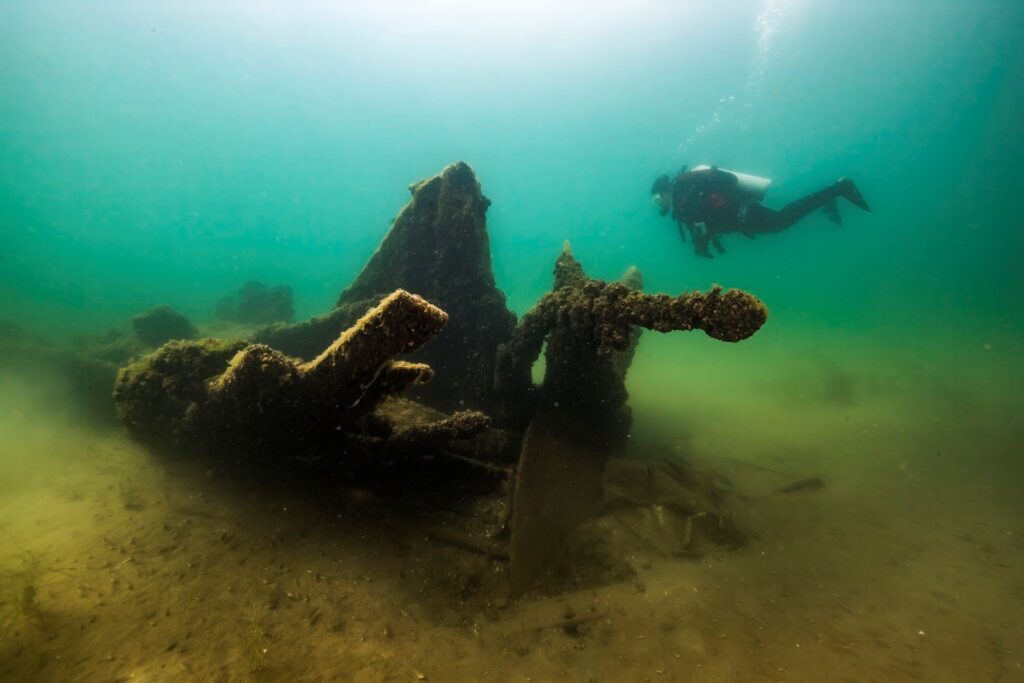
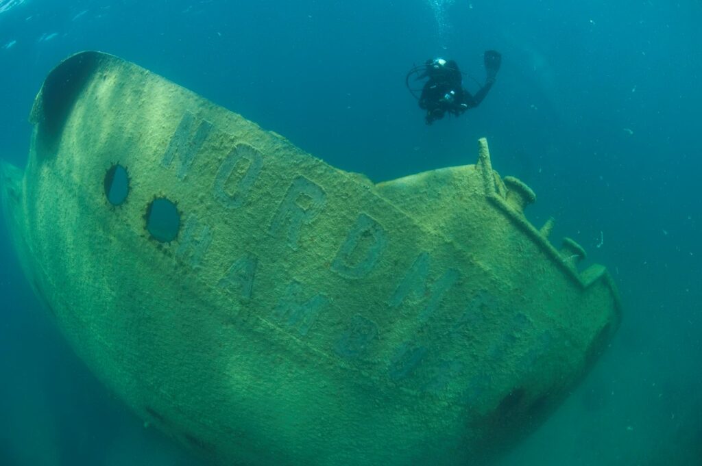
TBNMS encompasses 4,300 mi² of Lake Huron off the northeastern shore of Michigan, and is home to many culturally important shipwrecks. However, a large area of the sanctuary remains unmapped. Approximately 16 percent of the lakebed within the sanctuary has been surveyed, and much of the mapping was completed prior to 1950 when techniques were more primitive. Updated lakebed maps are needed to better detect, characterize, and monitor submerged resources and ecologically important areas within TBNMS. Modern mapping technologies can not only locate new shipwreck sites, but also provide more accurate and resolved depths, and also characterize the substrate types of the lakebed.
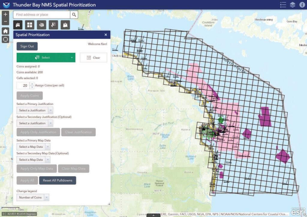
However, the sanctuary is vast and the entire area cannot be mapped in a short time frame. To identify the various mapping needs within TBNMS, NCCOS developed a digital atlas to efficiently gather input on mapping priorities from multiple stakeholders. Researchers invited a diverse array of respondents to participate in the effort, including archaeologists, biologists, coastal and fisheries managers, and other groups. The common thread among all respondents was that they relied heavily on lakebed maps within the sanctuary as a key input to their research or management decisions.
Using the application, each respondent was given 200 virtual coins to place anywhere within the project area that they felt was a priority for future mapping, and convey their recommendations what types of map data are needed, when the products are needed, and to justify why the site is a priority for mapping. The system then standardized inputs using a geographic information system (GIS) framework, enabling researchers to identify shared mapping interests.
The results from this prioritization effort will be used by researchers and managers to identify collaborative opportunities in locations where their interests overlap, and improve the efficiency of future mapping projects in the sanctuary. This report and prioritization effort were part of a larger NCCOS-funded project to support mapping in Lake Huron’s Thunder Bay National Marine Sanctuary (see TBNMS Management Plan).