The 2025 York River Watershed System Symposium featured new research from NOAA’s National Centers for Coastal Ocean Science (NCCOS) Social Science Team that assesses outdoor recreation in coastal Virginia. The project, a collaboration with partners across the region, analyzed visitation trends, access to water, and recreation suitability to support better-informed management and planning across the York River Watershed.
NCCOS social scientists delivered a presentation on this research at the symposium. The presentation, “Assessing Outdoor Recreation along the York River Watershed: Suitability, Accessibility, and Visitation Trends,” focused on three key components: tracking visitation trends across parks and natural areas, mapping existing public access to water, and developing geospatial indices for hiking and shore fishing suitability.
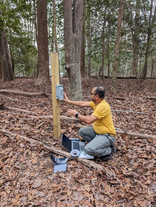
Researchers installed eight vehicle and pedestrian counters at state, county, and national parks in the watershed, including Gloucester Point Beach Park, York River State Park, and Yorktown to understand visitation patterns. Calibrated using on-site observations, these counters provided detailed estimates of over 94,000 visitors to Gloucester Point Beach alone between March 2024 and February 2025. Peak visitation occurred on July 4th, with more than 1,200 vehicles counted that day. Data like this can help managers plan staffing, programming, and facilities more effectively. Learn more about tracking visitation trends.
To assess public access to water, the team updated an existing dataset of water access infrastructure – like boat ramps, docks, and marinas – to show where access is concentrated and where gaps remain. Using shoreline inventory data from the Virginia Institute of Marine Science (VIMS), their analysis found that while nearly 80 percent of the study area lies within a short drive (10 km) of public water access, only 15.5 percent is within walking distance (1 mile), highlighting potential barriers for people without personal transportation.
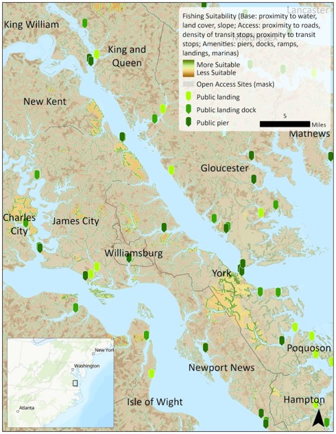
In addition, researchers developed two suitability index maps – one for hiking and another for shore fishing. These geospatial tools combine data on slope, land cover, transit access, and existing amenities to identify areas with the greatest potential for outdoor recreation. Managers can use these maps and underlying databases to guide future planning and investment, ensuring that coastal communities are equipped to meet growing demand for nature-based recreation.
The assessment was supported by partners across the York River Watershed area, and NCCOS plans to publicly share the datasets and tools developed through this work. These resources can help local coastal managers, planners, and communities enhance access to nature and the benefits it provides. By supporting locally informed decisions, these resources contribute to broader NCCOS efforts to enable sustainable use of coastal resources by assessing human use, and to enhance the social and ecological resilience of communities along the York River.
Learn more about this ongoing project.