NCCOS recently completed the spatial analysis that will guide the prioritization of future seafloor mapping, research, and exploration in the U.S. Caribbean.
With input from regional stakeholders, the research team developed a spatial framework and a web-based mapping tool to identify common management priorities for Puerto Rico and the U.S. Virgin Islands (USVI). These products will support strategic planning for local organizations and encourage collaboration based on similar data needs. The spatial framework developed helps answer questions such as:
-
-
- Which locations are important?
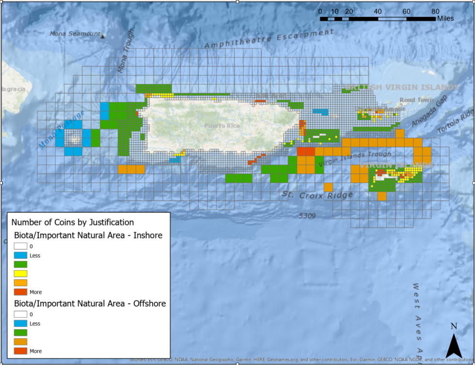
- Why are they important?
- How quickly are data needed?
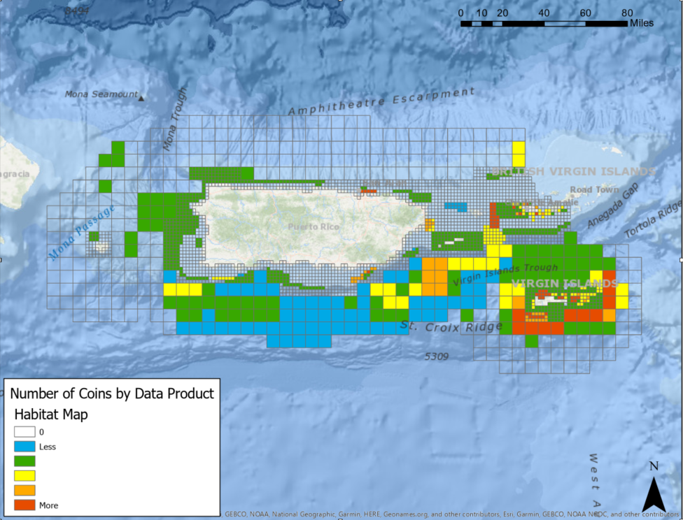
- What data products are needed most?
-
The researchers invited 23 local jurisdictional organizations to participate in the prioritization effort, with one representative from each organization having direct access to the web-based mapping tool. Using the tool, respondents were able to place a limited number of “coins” into a nearshore grid (shoreline to 100 meters deep) and an offshore grid (100 meters deep to 24 nautical miles from land) for both Puerto Rico and USVI. Respondents were also asked to choose from a list of justifications (e.g., exploration, research, human uses) and products (e.g., habitat map, photos/videos, samples) to associate with their input.
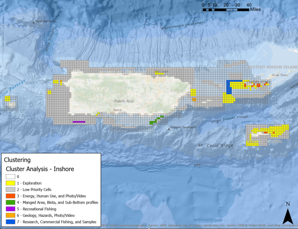
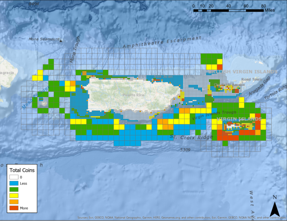
A total of 15 organizations provided input across all regions using the mapping tool. The researchers summarized and normalized coin totals across the inshore and offshore regions. Figures 1 through 4 are examples of just a few prioritization maps that were created using these results. To view all of the results from the analysis, visit the U.S. Caribbean Prioritization Results Online Application.
Detailed methods and results of this analysis are also available in NOAA Technical Memorandum NOS NCCOS 286 (2020).
The project was supported by NOAA’s Coral Reef Conservation Program.