NCCOS-supported scientists documented that the 2014 “dead zone” (area of hypoxia, or low oxygen) in the northern Gulf of Mexico west of the Mississippi River delta now covers 5,052 square miles of sea floor,or about the size of the state of Connecticut. Though average in size and smaller than last year, the dead zone area still surpassed the Mississippi River/Gulf of Mexico Watershed Nutrient (Hypoxia) Task Force target of 1,900 square miles, indicating that nutrients from the Mississippi River watershed are continuing to affect the nation’s coastal resources and habitats in the Gulf.
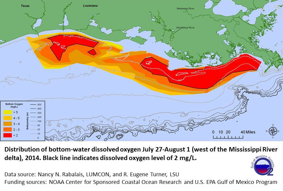
The observed dead zone area falls within the predicted June forecast range of about 4,600 to 5,700 square miles, confirming the accuracy of the NOAA-sponsored models based on the USGS May nutrient load data from the Mississippi River.
The dead zone was measured by scientists from the Louisiana Universities Marine Consortium (LUMCON) and Louisiana State University aboard the RV Pelican. NOAA has supported the mapping of the dead zone in the northern Gulf of Mexico since 1990.
For more information, contact Alan.Lewitus@noaa.gov.